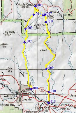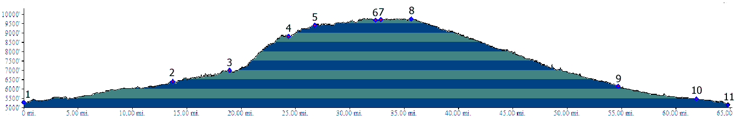
01.(5280ft,mile00) START-END WEST: jct US50 and what
becomes Fields Ave, Canyon City.
02.(6600ft,mile14) jct with Trail Gulch ( lower end of
Shelf Road).
03.(6990ft,mile19) site of Marigold
04.(8800ft,mile25) Aregua Gulch joins on righy
05.(9400ft,mile27) profile turns right from Shelf Road
onto Co67
06.(9700ft,mile33) Victor
07.(9700ft,mile33) profile turns right from Co67 onto
Phantom Canyon Road
08.(9760ft,mile36) TOP: aproximately highest point
09.(6130ft,mile55) first tunnel from bottom
10.(5470ft,mile62) START-END EAST: start of Phantom
Canyon Rd at jct US50 - Co67.
11.(5160ft,mile65) START-END EAST ALTERNATE: Arkansas
River crossing on Co67, just north of Florence