| |
| |
Hoosier Pass (Pike's Peak)
This second, not-so-famous Hoosier
Pass is a county dirt road on Pikes Peak, between
the old mining towns Victor and Cripple Creek.
Pike's Peak had its own mining boom and the towns
and dirt roads to prove it. Colorado has many
mining towns to choose from, but me Victor is the
best. It too has been gentrified, but
gentrification on the slopes of Pike's Peak goes
along slower than say Telluride for example. There
are many other possible summit points in this
area, that are not honored with an official pass
name. But this point is even included on National
Forest maps.
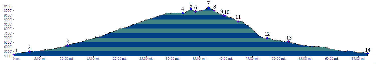
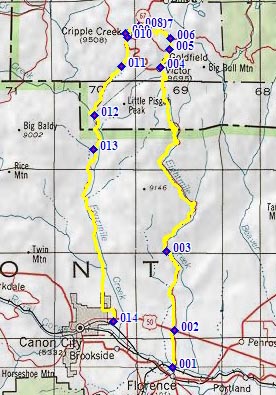
There are many ways to approach this point. But starting somewhere at the bottom of Pikes Peak, the most obvious way is Phantom Canyon as one approach and Shelf Road as the other. The profile shows that option. Phantom Canyon / Shelf Rds(u) is a popular gravel ride. Another longer possibility from Colorado Springs is US24 towards Ute Pass, followed by Co67 towards Cripple Creek one the north side side, and Gold Camp Road (or a variation of that) on the other side. Because of the traffic on US24 this is a much less pleasant option. But I include it, partly because I rode it once when there was much less traffic. 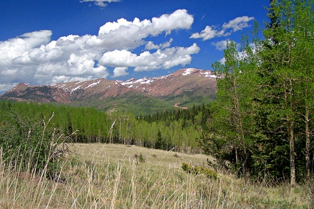 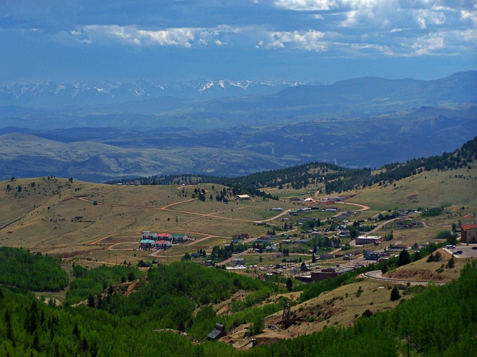 There are many more pictures of the Phantom Canyon and Shelf Road approaches on that page. This page has two pictures of the upper Gold Camp Rd option, and one of the summit area between Victor and Cripple Creek.
From South-West. After Phantom Canyon reaches pavement, just
before Victor, the profile turns right instead,
following Co82 away from this town. It climbs the
paved road to Goldfield to the top of old historic
Victor Pass. Going left at the top of the pass,
back onto gravel over Cameron Rd and CR82 leads to
a far view of the huge mining operation below. But
there are also some nice views towards the top of
Pike's Peak and especially Cripple Creek. A paved
right at the top of the pass leads to another
mining operation. But - going over Victor Pass, taking the next
left onto Gold Camp Loop Road will do the trick.
In either case Victor Pass is only a shoulder
point because the decent from it does not exceed
300ft.
(described downwards) To pick up Shelf Road, you
travel through Cripple Creek back direction
Victor. The turnoff comes immediately after
exiting town. It is easy to miss because the
junction is only signed with a county road number.
Going down the road a 100ft or so, an
informational signs verifies that you are on the
right route.
PARTIALLY PAVED / UNPAVED Hoosier Pass: Woodland Park[1] > US24
west > Co67 south > Cripple Creek[2]
<< going back a short distance on Co67 north
> CR82 east > Hoosier Pass > Gold Camp Rd
east with possible variations > Colorado
Springs > US24 west back to starting point: 93
miles, no elevation measured (mechanical odometer:
m1.86.09.28). Hoosier Pass , Victor Pass: Starting at a
campsite just below the first tunnel in Phantom
Canyon > up Phantom Canyon > detour through
Victor > Victor Pass > CR82 > Hoosier
Pass > CR820 > Cripple Creek > down Shelf
Rd > Canyon City >Mc Kenzie Rd > back to
starting point: 70 miles with 5700ft of climbing
in 6:3hours (m3:10.6.10) 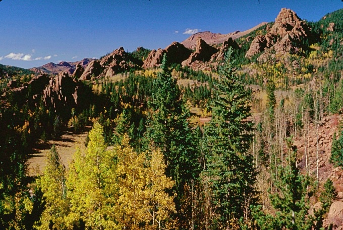 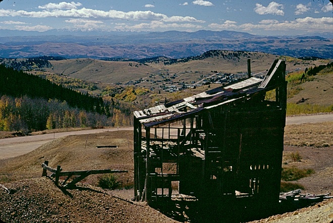
|
 Approaches
 The first part of this decent is a
regular dirt road. But the road becomes true to
its name south of the Pisgah Peak area, as it
clings to the west side of a canyon. At the end of
the shelf portion the road becomes paved. and
descends leisurely into Canon City. More details
on the
The first part of this decent is a
regular dirt road. But the road becomes true to
its name south of the Pisgah Peak area, as it
clings to the west side of a canyon. At the end of
the shelf portion the road becomes paved. and
descends leisurely into Canon City. More details
on the |
|
advertisement |
|
|
advertisement |