| |
| |
FR400 Gardner Road s(u)
Two roads cross the Wet Mountains
in the east west direction, this one and the paved
Hardscrabble Pass.
One of the nicest things about this forested range
is its locotion next to Sangre de Cristo Range,
because of the views. The Wet Mountains also have
three other named divides, but they run along
lower valleys in a north south direction. None of
them reach nearly as high as this crossing or have
comparable views.
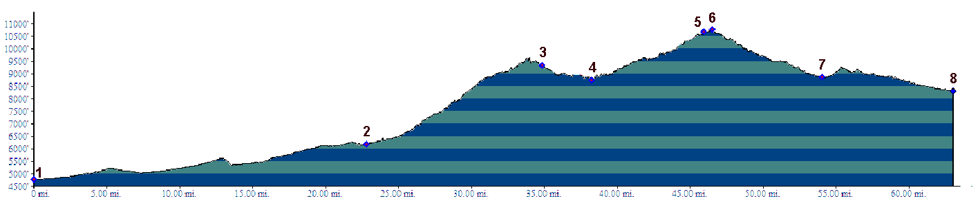
The entire route along the profie has various numbers assigned to it along the way, but the summit is on FR400, also called Gardner Road. But you don't go through Gardner for the most obvious loop ride over this summit.
Approaches From East.To show the maximum possible
elevation gain, the profile starts in Pueblo and
follows Co78 to Co65, and the crosses Greenhill
Divide to the turnoff labeled "Ophir Campground".
A number of other routes are possible for this
lowest portion of the climb, and none of them are
necessary to construct a loop ride over this
summit. Arriving on Co65 the turnoff onto FR400 is signed
only as "Ophir campground". The good dirt road
soon turns left, while the straight ahead option
leads onto something named "Little Froze Road"
according to the sign. "Little Frozen Road" might
make more sense, but the real name is so quirky,
it's easier to remember. FR400 on the left climbs between rounded hills,
following every contour of the land in seemingly
endless curves through dense forest, made of
evergreens and aspen. The ridge line to the west
never seems far away, but instead the road opts to
contour higher towards Greenhorn Peak. After a
long exhausting climb the road suddenly emerges
out of dense forest onto a prominently signed 4
way intersection. This is very close to the top,
but the highest point is just a little further
straight ahead. To the right FR4011 keeps climbing higher on
worse surface to Deer Creek Peak. To the left
FR369 goes to Greenhorn Peak. My notes from the
ride say that the straight ahead option is labeled
as FR634, but the De Lorme Gazeteer map keeps the
FR400 label over the summit. Whatever its number,
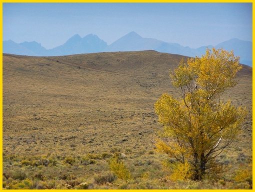
a spectacular far vista waits, the Sangre de
Cristo Mountains in the background, in the
foreground large rounded hills separated by
isolated stands of Aspen. At the point of highest
altitude the road curves to the north and the view
takes in the entire northern part of the range.
During September 2012 views were completely
obscured by haze from far forest fires.
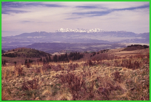
From West. (described downwards) A
constant panorama remains through several
northward sweeping traverses of the road. A sign
informs that you are exiting San Isabel National
Forest. Past this are two turnoffs on the right
that give the impression of being private roads.
They are not, they are public roads through
private land. Especially the second unmarked
turnoff is useful if aiming for the northern part
of the Wet Mountain Valley and the profile follows
this option down into the Wet Mountain Valley. The
name "Gardner Road" is only found on the Gazetter
maps, but on none of the signs. This alludes to
the option of going straight instead and aiming
for the southern part of the valley.
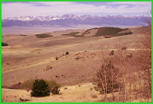
Following the profile down for the northern
option, slowly a few private residences, vastly
outnumbered by "for sale" signs appear, as the
valley draws closer, and the mountains take on
more detail if it is a hazy day. Some of the lower
parts of this road have extreme washboard
characteristics, but they this does not last very
long. By the time the road merges onto Co69, it
has become CR305 Centennial Ranch Road, and is
labeled as such in very small letters at the Co69
turnoff. CR105 is across from it. Dayrides with this point as highest summit: PARTIALLY PAVED/UNPAVED (<Hardscrabble
Pass|Colorado
Trail m272.1 s(u)>) --------------------no measured
altitude------------------------- same summit points: FR400 Gardner Road
s(u) , CR329 - 347 Rosita Rd s(u) , campsite on
FR400 Gardner Rd > FR400 Gardner Rd s(u) >
down CR305 Centennial Ranch Rd > Co69 north
> CR328 Rosita Rd west > CR329 - 347 Rosita
Rd s(u) > Co165 south > Wixson Divide >
Bigelow Divde > up FR400 Gardner Rd back to
starting point: 66miles (mech Odo m1:91.5.31)
|
|
|
advertisement |
|
|
advertisement |