| |
|
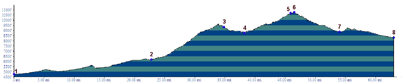
1.(4780ft,mile00) START-END EAST ALT: Pueblo; profile follow Co78 east
2.(6190ft,mile23) eastern turnoff to Beulah
3.(9340ft,mile36) route turns left onto Co65 at Greenhill Divide
4.(8770ft,mile39) START-END EAST: profile turns left onto FR400
5.(10660ft,mile46) 4 way intersection to Deer Creek Peak and Greenhorn Peak
6.(10780ft,mile47) TOP
7.(8860ft,mile55) profile turns right onto unmarked CR305
8.(8320ft,mile63) START-END WEST: jct CR305 - Co69, between Bradford and Westcliff, Wet Mountain Valley