| |
| |
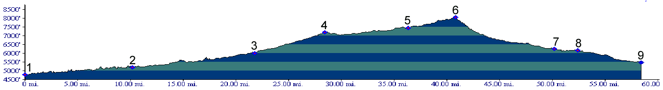
Alkali Creek - Road Gulch
summit(u)
This unofficial divide connects
the New Castle/Silt area with Colbran. The road
climbs across a gap between Grand Mesa and
Battlement Mesa. Except for a short steep stretch
near the top of the eastern approach this is a
shallow, steady climb that still manages to climb
over 2500 and 3500 feet respectively on each side.
My favroite time to ride this divide is during fall, when Grand Mesa is at its most colorful and the far views are unobscured by haze. That makes fall better than the spring. A time other than hunting season is another advantage. During hunting season a cycling outfit with a high orange content provides a extra measure of confidence for not being mistaken for a piece of wildlife or a stray cow. The top of this divide is close to the route over Buzzard Divide. My edition of Helmuth's book "Passes of Colorado" describes the eastern approach to this divide as part of a route across the Buzzard Divide. But a look at the map will verify that the Buzzard Divide road clearly joins on the west side of Alkali Creek - Road Gulch summit(u).
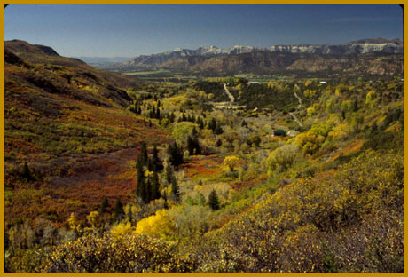
From West. The profile begins at exit 49
of I70. The paved road follows the incised
meanders of Plateau Creek, also the very bottom
part of a paved climb to Grand Mesa
summit(u). Instead of continuing to the town
of Mesa, a left turn onto Co330 leads onto a paved
country road that rolls up and down between farms
and the distant escarpments of Grand Mesa and
Battlement Mesa. In past years this narrow road
often had virtually no traffic. But since the
natural gas boom in the area this has changed
somewhat.
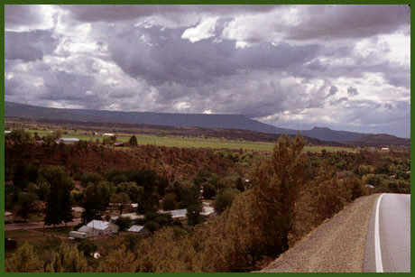
From East. (also described upwards) There
are many ways to approach point 7 on the profile.
The route chosen is the most direct from New
Castle. It is also the route in the overnight trip
route description below. Leaving New Castle, East
Divide Road is paved and accessible after crossing
to the south side of the Colorado River, and
following the valley westwards. Pavement lasts to
point 8, followed by a very short section of
gravel, until the surface improves again to
"reasonably hard medalled" (Oct/05). The barely
ridable deep gravel road of past years seems to
have become history since the natural gas boom.
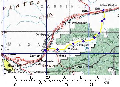
A day on a two-day weekend tour: PARTIALLY PAVED / UNPAVED:
Escalante Expedition:(<Buzzard-Muddy Creek
Divide|Douglas
Pass>). This divide, that today
receives attention only from hunters and oil
companies plotting new ways to fracture
underground rock layers in order to extract gas,
was probably on the route of the Escalante
expedition in 1776. It certainly would have been
the easiest and most logical route between the Buzzard-Muddy Divide
and the Colorado River. Marshall Spraque in his
book "the Great Gates" speculates that this was
so.
|
 Approaches