| |
| |
Green Mountain Rd - Mine
Acess Rd(sh)
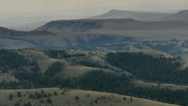
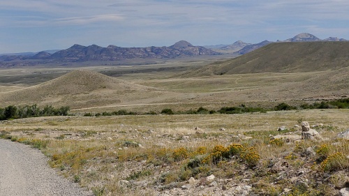
Green Mountain Road leads over one
of Wyomings "islands in the sky", overlooking the
vast, and this case not quite so empty dessert
below, because the Granite Mountains are anything
but empty. Much of the land there has been divided
up into private ranches. One thing about the Green
Mountain Rd loop, it is a little short for an
entire day outing. Enter a way down the north side
of the Green Mountains. The profile below chooses
one of the approaches to the Green Mountain Loop
Rd(su) for the south side, the one that is the
shorter of the two. This results in a different,
slightly lower summit point, In my opinion, the
other option of using the western option of the
Green Mtn Rd is actually a little more scenic,
because of more numerous far views. In that case
the highest point remains Green Mtn Rd s(u).
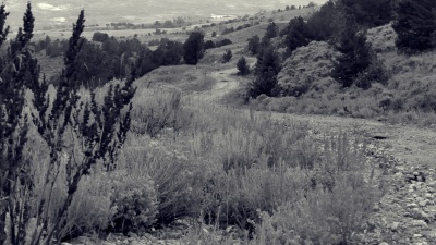
 telephoto view from upper Mine Access Rd 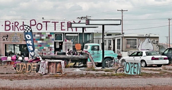 Jeffries City From West. (described
downwards) On the left is an out and back to a
viewpoint: Wild Horse Point. The right leads to a
one last short climb towards the highest point on
Green Mountain Road. But before getting there and
this profile continues straight, while Green Mtn
Loop road turns right. It ducks under a gate and
picks up the road behind the big sign saying "Mine
Acess Road - no public access". It says nothing
about using the road through the publicly
inaccessible land. The road is a mixture of major
mining highway and abandoned road, all very easily
ridable, even if it is not the fastest surface.
Signs from a past era of truck traffic announce
"tight" curves, and large piles of horse apples
announce the competiton between various male
horses, while marking their turf. I saw a total of
3 wild horses on the way down. Their grey color
blended with the grey of the burned brush and
stunted tree landscape all around.
A sign there explains its existence
as the ultimate boom and bust town, caused by the
uranium boom-bust cycle in the early/mid 1980s.
Today it is a friendly collection of partially
abandoned buildings, sprinkled with RVs ranging
from wreck to modern warrior and a very friendly
church, that welcomes cyclists who want to stay
there overnight. 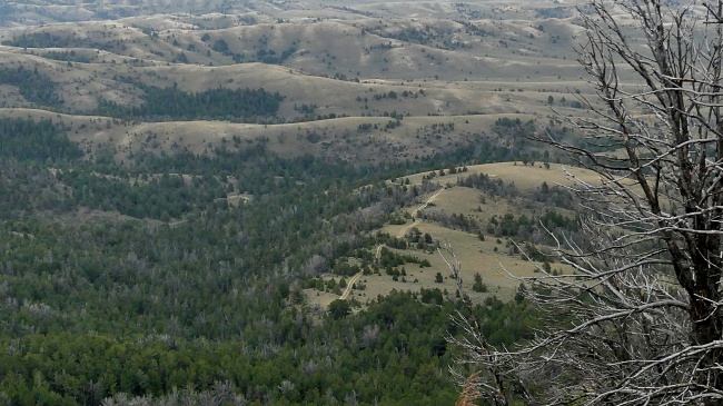
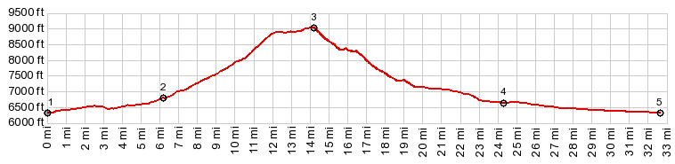
Dayride with this point as highest summit PARTIALLY PAVED / UNPAVED ( < Green Mountain Rd s(u) | Limestone Mtn Rd s(u) > ) Green Mountain Rd - Mine Acess Rd(sh) : jct US287 - Green Mountain Rd > up Green Mtn Rd > up eastern branch of Green Mtn Rd > Green Mtn Rd - Mine Acess Rd (sh) > down Mine Acess Rd > Big Eagle Rd west > Crook's Gap Rd north > sightseeing detour around Jeffrey City > US287 east back to starting point: 41.7miles with 3130ft of climbing in 5:44hrs (garmin etrex32x m5:23.09.05) Notes: a rare day of almost no wind in Wyoming made for an almost perfect loop. Without the haze it would have been perfectly perfect. |
 This
mine acess road has been steadily heading west.
Approaching the mine property I always chose the
option that went as downhill as possible, while
continuing to head in a northerly direction. It
worked fine, and I imagine there are several
options. The profile finally merges on an
extremely wide unpaved mine highway, that makes a
gently declining raceway along the south side of
Green Mountain. It finally becomes the Crook's Gap
Couinty Road. If one wants to continue south on
the Crook's Gap Rd it actually requires a
conterintuitive turn west that does not show up on
many maps. Most of the traffic from Crook's Gap
heads to the mine, and so the expected size and
importance of the roads is not what the map would
lead to suspect. A pleasant almost imperceptible
decline leads into Jeffrey City, and a junction
with US287
This
mine acess road has been steadily heading west.
Approaching the mine property I always chose the
option that went as downhill as possible, while
continuing to head in a northerly direction. It
worked fine, and I imagine there are several
options. The profile finally merges on an
extremely wide unpaved mine highway, that makes a
gently declining raceway along the south side of
Green Mountain. It finally becomes the Crook's Gap
Couinty Road. If one wants to continue south on
the Crook's Gap Rd it actually requires a
conterintuitive turn west that does not show up on
many maps. Most of the traffic from Crook's Gap
heads to the mine, and so the expected size and
importance of the roads is not what the map would
lead to suspect. A pleasant almost imperceptible
decline leads into Jeffrey City, and a junction
with US287|
|
advertisement |
|
|
advertisement |