| |
| |
Wauconda Pass
This is one in a series of gentle,
forested, long, straight pass roads on Wa20, as it
makes its way over one gentle mountain range after
another between the Pend Oreille River and the
Cascade Mountains. Some maps also label this as
Wauconda Summit.
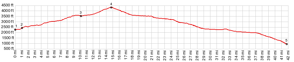
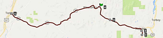 Approaches This side is a long, gentle climb on an
undulating road in the forest. The top is a
generic piece of forest. There is a single pass
sign.
From West. But the
scenery changes just after the top. Fields take
the place of some of the forest. Abandoned old
farm structures add to the scenery. Interspersed
in the mix are also generously watered lawns and
new retirement housing built during this or the
previous real estate boom. As Tonasket draws
closer a third type of residence becomes a common
road side view: trailers and wood structures
organized around old junk cars and piles of
refuse. Miles before Tonasket, the road alternates
between almost flat stretches and 5 to 6 percent
slopes along a creek. When Tonasket finally shows
up below, the transition to an arid landscape is
complete: This could be a busy agricultural town:
Someplace, Arizona. The traffic becomes much more
heavy and aggressive close to town. 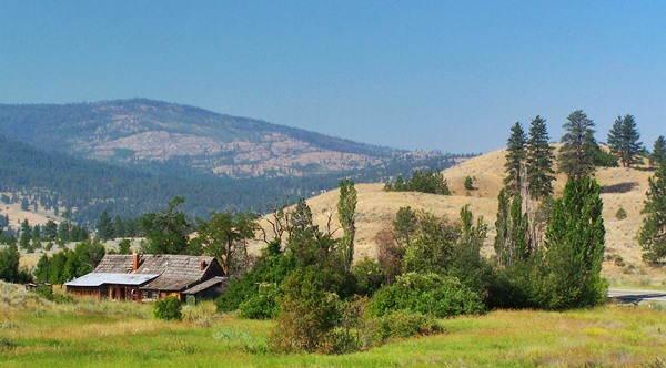 Dayride with this point as highest summit: PARTIALLY PAVED / UNPAVED ( < Sherman
Pass | Loup
Loup Pass > ) 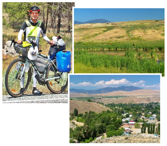 |
|
|
advertisement |
|
|
advertisement |