| |
|
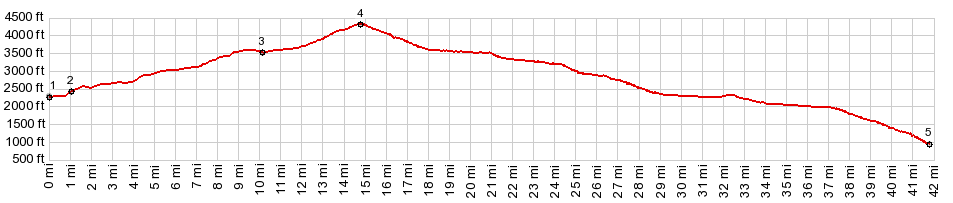
1.(00.0m,2290ft)START-END EAST: low point on Wa21, just south of Republic
2.(01.0m,2440ft)jct Wa20 - Wa21, just south of Republic
3.(10.2m,3520ft)jct with Granite Creek Rd
4.(14.8m,4320ft)TOP: Wauconda Pass
5.(41.7m,0970ft)START-END WEST: jct Wa21 - US97, Tonasket
|