| |
| |
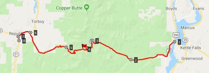
Sherman Pass
This is the highest, paved road
pass, that the state of Washington keeps open all
year round. It tops out at over 5 and a half
thousand feet, and the trees reach at least
another 500ft higher. The entire road goes through
deep Washington State forest, not counting one
"forest fire" overlook, which grants a limited
view into the valley. In the summer this does have a
positive aspect. A healthy forest cover shrouds
the road in a dark, deep green shade. Although I
sometimes wonder if the ridge, just on the other
side of the road has been clear cut. They seem to
manage view sheds very carefully in the great
northwest. It seems, where-ever you cannot see
from a major road, they cut all the trees. Some maps use the name Sherman Creek
Pass for this shallow, steady, but long climb in
the Kettle Range. This is a fairly popular ride.
All the people I saw and talked to were solitary
touring types with full paniers.
 Approaches
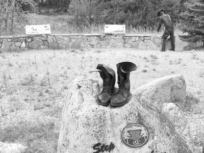
A separate information sign about the pass
mentions old Indian trails, settlers, and
pioneers, without offering any facts of anything
that actually happened. Maybe the writers did not
want to appear too heavy handed or "teacher like"
to the casual vacation crowd.
From West. (described
downwards). About 500ft down another turnoff
celebrates "the rich fire fighting history" of the
Colville National Forest. It seems this history is
only going to get richer, with global warming and
all that. But the signs don't mention that -
probably too controversial in this conservative
area. The trees continue in unabated thick
splendor during the sporadic roll down. There is
hardly a shoulder on this side, but traffic is
easily bearable. The drop ends a the jct of Wa20
with Wa21, 3 miles east of Republic. Riding those last three miles, the town Republic
(2 grocery stores) is actually located on a small
uphill, while Wa21 drops further, especially
during the first mile. After that it follows a
river valley downstream
Dayride with this point as highest summit: ( < FR5080
King's Lake Rd - Halfmoon Lake Rd s(u) | Wauconda Pass
> )
|
 The road and the trees
continue unabated. The top is located in a rock
cut without views, making a completely ordinary,
not particularly attractive pass sign the forced
focal point of celebratory actions, staged by
theatrically inclined cyclists, arriving at the
top of a new summit.
The road and the trees
continue unabated. The top is located in a rock
cut without views, making a completely ordinary,
not particularly attractive pass sign the forced
focal point of celebratory actions, staged by
theatrically inclined cyclists, arriving at the
top of a new summit.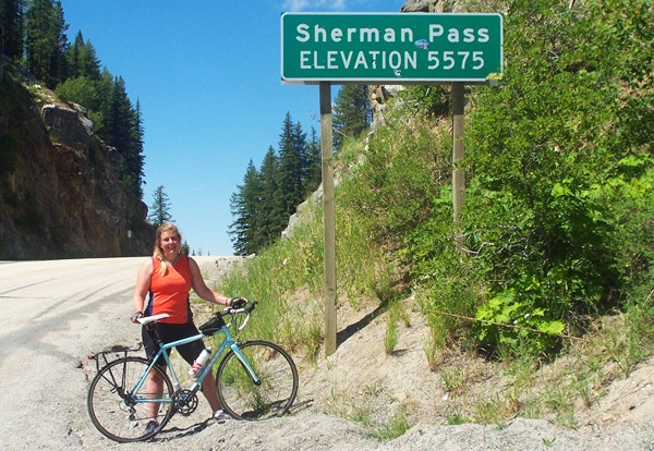
|
|
advertisement |
|
|
advertisement |