| |
| |
Washington Pass
Washington Pass is the center piece of the state's North Cascades Highway. If there were such a thing as "Colorado Pass" it would have to be Trail Ridge Road. If there were a "Wyoming" or "Montana Pass", it would have to be what is really named Logan Pass (or "Going to the Sun Road"). I have never before been tempted to call scenery "voluptuous", but I can't think of anything else fitting for all the vertical greenery of Washington Pass. Washington Pass gets lots of cycling
traffic, also because it is part of Adventure
Cycling's Nortern Tier route. All that being said,
it won't come as a surprise, that this is a
typical bombastic US highway. It has good
shoulders, is rumble stripped only in the middle,
and you can see even the slightest change in
direction or grade at least 10 minutes before you
get there (measuring the time in an upward
direction). This road has been designed so that
people can tow their boats to Lake Ross with the
gas pedal stuck to the floor. During busy times in
the summer, traffic can be heavy, loud, fast and
obnoxious - much more so than on the other US20
passes further east, in my experience. ... and one more point about the
North Cascade Mountains. They are an impressive
large area of mountains, stretching from here up
to Canada and also some distance to the south.
Unfortunately, if you confine yourself to paved
roads, the terrain that can be explored on a bike
is very limited. Using unpaved roads does not add
that much terrain, See Hart's Pass for
example..
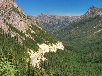
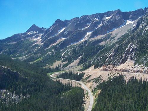
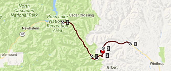 Approaches From the scenery, you could almost mistake this
entire pass for just a single valley, if it were
not for a single incline before the summit, and
the slight change from up to down following it. On
state maps it looks like the road makes a tight
switchback a mile or two before the summit. In
reality at least a stadium of some sort would fit
inside the radius of that curve. A single, short
but massive roadcut leads to a forested summit. The numbers of tourists arriving here is large
enough, that the forest service has obliged their
desire to exit their cars, by constructing and out
and back road to a viewpoint and a short scenic
walk. Both go a little higher than the summit. The
parking area here is large enough to accommodate
the large and international summer crowds. The
forest service has abstained from charging the
high parking fees, that are usual for all
trailhead parking along this road.
For such a sparsely populated area, a road
project as massive as Washington Pass was a big
effort. An informational tablet includes a short
history of the road, which make this pass sound
like the 9th wonder of the world. To hammer home
the point, the tablet gives a figure in dollars,
that was required to construct the road, a number
that is totally meaningless in today's money, but
is meant to impress. There are no services of any kind between Mazama
and at least Ross Lake, The store in Mazama sells
mostly iron cookware which is of limited use on a
bicycle tour. Actually I seem to remember some
home made jams and 5 or 6 dollar gallons of milk
too. The last grocery store on this side was in
Winthrop.
From West. (described
downwards). - A long valley ride, which includes
an uphill in the downhill direction. The single through going road funnels heavy
tourist traffic to a few nature access points and
trailheads. This makes for very busy trailheads. A
conceivable response might be to build more roads
into the mountains, and provide better access, so
that the traffic spreads out over a larger area.
Instead the response here seems to be discourage
use by charging high parking fees. Rainy Pass on the same road is marked on most
maps a few miles west of Washington Pass. As far
as the road is concerned it is only a shoulder
point, with less than 500ft climbing on one side..
The Pacific Coast Trail crosses here and there is
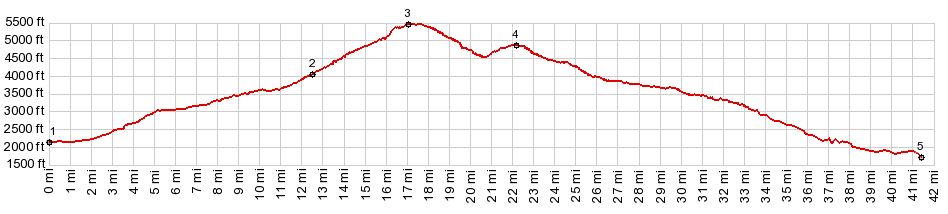
also a picnic area. Dayride with this point as highest summit: COMPLETELY PAVED: ( < Hart's
Pass| Burpee
Hill Rd(sh) > ) |
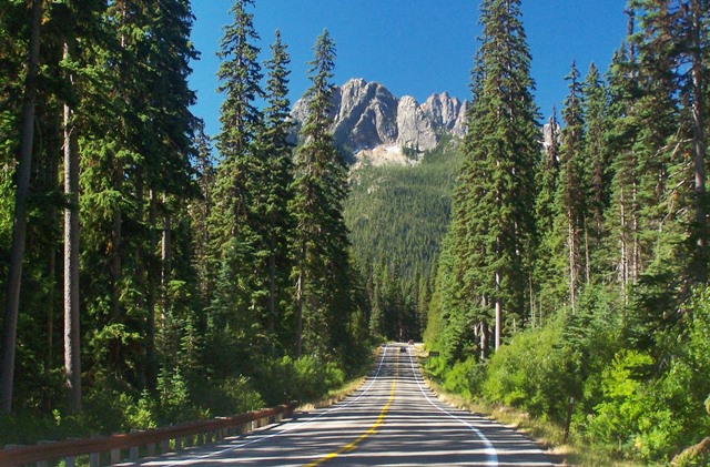
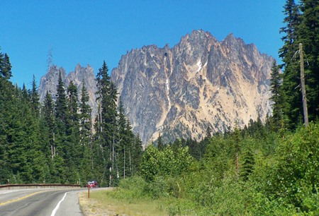 From the summit the
short paved foot trail trails threads through some
mossy trees and gives a fine view of the final
road cut to the summit and the impressive peaks
behind it. You are still many thousands of feet
below being able to look across these ridges.
From the summit the
short paved foot trail trails threads through some
mossy trees and gives a fine view of the final
road cut to the summit and the impressive peaks
behind it. You are still many thousands of feet
below being able to look across these ridges.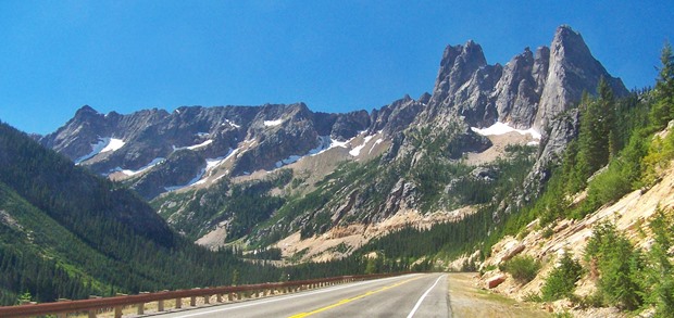
|
|
advertisement |
|
|
advertisement |