| |
|
|
|
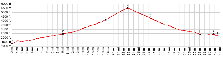
1.(00.0m,1320ft)START-END EAST:US20 bridge over Columbia River
2.(10.1m,2510ft)jct with South Fork of Sherman Creek Rd
3.(18.5m,4180ft)North Fork of Sherman Creek Rd crosses US20
4.(22.8m,5587ft)TOP: Sherman Pass
5.(27.3m,4260ft)jct with Karamip Rd on right
6.(37.0m,2420ft)jct with Wa21 on right
7.(39.7m,2440ft)profile turns left down Wa21, just before reaching Republic
8.(40.6m,2290ft)START-END WEST: low point on Wa21
|