| |
| |
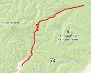
Chinook Pass
This is a big climb on the
west side of Mount Rainier, with a scenic top
section across from the perpetually snow
capped mountain. de Lorme Gazeteer maps label
this spot as Yakima Pass. All signs in the
area use "Chinook Pass".
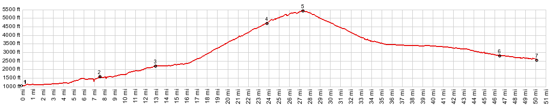
From East. The profile
goes up the southern approach to Cayuse Pass.
This is a long steady climb in the forest. Wa123
through Rainier National Park, does not really
have a shoulder, but also much less traffic than
the previous US12 or the following Wa410. The
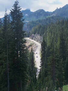
most interesting section starts at the top of Cayuse Pass.
Several switchbacks wind up another 1000ft in
elevation, across from Mount Rainier. This
section has a shoulder that can be used for
climbing. The one view surpassing everything
else on this huge climb is the view just before
the top, with Dewey Lake in the foreground, and
hopefully not too many cars parked next to it,
while Mount Rainier high above and in the
background is putting on a cloud show.
Immediately after this spectacle the road goes
through a big wooden gate with a historic
national Park flair, announcing "Wenatchee
National Forest" to east bound travelers and
"Rainier National Park" to the west bound From West. This is just a
long traverse along a straight wooden ridge,
much like making your way down a large boat's
hull turned upside down. Climbing this
side can be a little unpleasant if the traffic
is heavy during the weekend. There are no turns
and nothing to keep the roadsters from flooring
their gas pedals. After entering the valley floor
after about 1500ft of unimpeded rolling, the
difference in the forest is striking. Over here
it consists mostly of lodgepole pines. Gone are
all the ferns and mosses, that thrive in the
wetter climate on the east side.
Dayride COMPLETELY PAVED: ( < TR216D
Abraham's Trail s(u) | Paradise s(u)
> ) - |
 Approaches
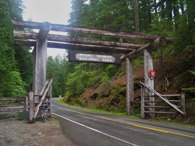
|
|
advertisement |
|
|
advertisement |