| |
|
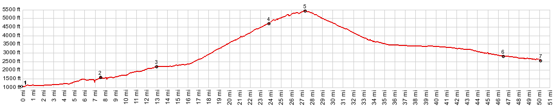
1.(1050ft,mile00.0)START-END SOUTH ALTERNATE: Packwood
2.(1620ft,mile07.6)profile goes left onto Wa123, while right goes to White Pass
3.(2260ft,mile13.0)jct with Stevens Canyon Rd to Paradise on left
4.(4675ft,mile23.9)profile goes right on Cayuse Pass onto Wa410
5.(5430ft,mile27.3)TOP: Chinook Pass
6.(2830ft,mile46.5)jct with with Bumping River Rd on right
7.(2590ft,mile50.1)START-END EAST: Wa410 crosses Naches River
|
|
-