| |
| |
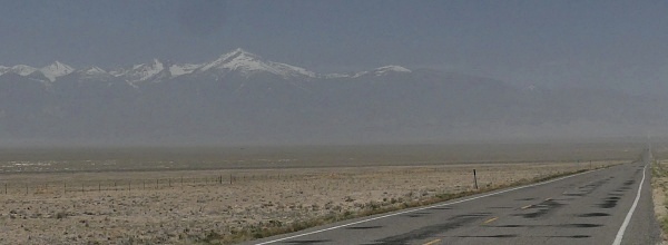
US6 Summit: Tule Valley -
Ferguson Dessert s(u)
On its dessert trek through
western Utah and Nevada, US6 climbs numerous small
dessert summits. This one is one of the few, that
is not named. But it does have a summit sign at
the top, and is considerably higher than the tiny
Skull Rock
Pass to its east. It also crosses, what I
think is the most interesting Basin/Range valley
on the whole Utah - Nevada trek.
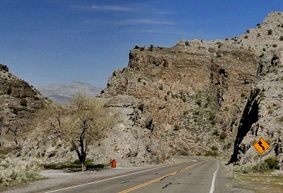
After Tule Valley, the road enters
the shallow, dry King Canyon, another nice
diversion for the endless straight away on the
other side. The top is signed as Summit without
name but with elevation. The ridgeline in Great
Basin National Park with becomes visible at the
top. It has Wheeler Peak (13063ft) as its highest
point. My map shows the road going to
6320ft, but the sign reads 6280 - close enough for
roadcut discrepancies.
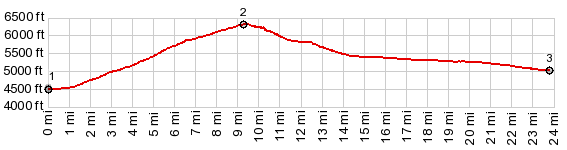
US6 reaches a low point out in the
dessert, slightly before the junction with
Ut159. That is where the profile starts - in
the middle of the dessert. From the jct with Ut159
the route starts to climb almost imperceptively in
a line straight. The road ahead is like a giant
arrow, and every point along it is clearly
visible. If you turn around every half hour, and
it is spring you will probably see Wheeler Peak
acquire additional layers of haze. So - something
in the surrounding views does change. After some time, the one noticeable
slight change of direction towards the left is
accompanied by slight upward slope change. At the
same point, a pleasant grove of evergreen dwarf
forest became settled. It marks the lowest point
of the alluvial fan towards the Confusion Range.
This range shows off one its more interesting
angles to stare at for extended amounts of time,
as the angle of view change ever so slightly over
an hour or two. The top is actually hidden behind
a road cut and small turn. So it is not obvious to
anticipate the arrival at the top. A truncated
view of the House Range and Notch Mountain appears
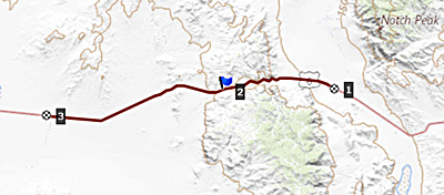
at the top. 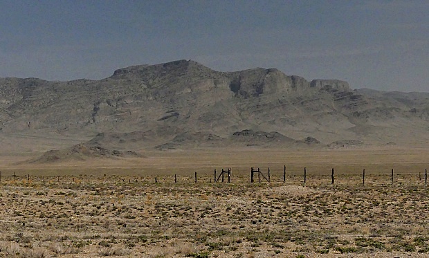 Dayride with this point a highest summit: COMPLETELY PAVED ( < Marjum Pass | Steamboat Pass > ) US6 Summit: Tule Valley - Ferguson Dessert x2: jct gravel road direction Crystal Peak Rd - US6 in Tule Valley <> US6 Summit: Tule Valley - Ferguson Dessert < turnaround point ~2+1/2 miles after crossing into Nevada at first junction with rd to Baker Archeological area: 80.5miles with 3570ft of climbing in 6:28hrs (garmin etrex30 r4:22.4.20 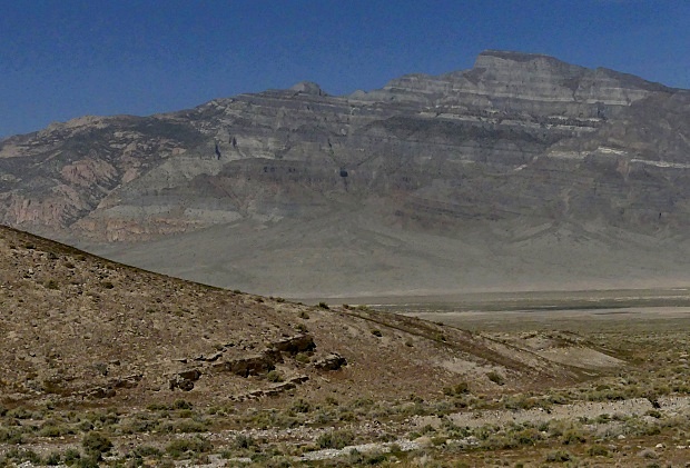 |
 From West. (also
described upwards) As an aside, there is a gas
station with free water and otherwise very
expensive food, about 2 miles east of the Nevada
state line, that is further to the west of the
profiled area.
From West. (also
described upwards) As an aside, there is a gas
station with free water and otherwise very
expensive food, about 2 miles east of the Nevada
state line, that is further to the west of the
profiled area.|
|
advertisement |
|
|
advertisement |