| |
| |
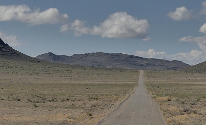
Steamboat Pass This pass is low. Whatever feels
like "a climb" is over before it begins. But I
wouldn't want to miss what this pass has to
offer. This is my favorite kind of scenery, far
open views to rocks and open expanses. The
surface is free of washboard. It also didn't
hurt that I had sunny clear conditions after a
two day combined dust/rain storm. - What an
incredible place the Utah western dessert is.
This last portion is on less used
track and crests in a wide gap, with a cliff
shaped like ship hull to the south. I imagine
that's where the name comes from. A track starts
here that looks like it can be used to get to the
crest of these low Black Hills
Heading north along the lake, the
route reaches a low point still more than a mile
distant from the lake's shore. That's where the
profile ends. Technically speaking you could get a
bit lower and closer to the lake on short detours
heading in an easterly direction.
Dayride with this point as
highest summit:
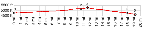
PARTIALLY PAVED / UNPAVED ( US6 Summit: Tule Valley - Ferguson Dessert | Headlight Canyon - Filmore Canyon s(u) > ) Steamboat Pass , Skull Rock Pass : near jct US6 - Tule Valley Rd > Tule Valley Rd south > Steamboat Pass Rd east > Steamboat Pass > Steamboat Pass Rd north > 3c Rd north > US6 west > Skullrock Pass > back to starting point near jct US6 - Tule Valley Rd: 52.7miles with 1980ft of climbing in 5:57hrs (Garmin etrex30m3: 22.4.23). Notes: I saw only one motor vehicle on the non-paved part (in addition to the dead car wreck), and that one was within a couple of miles of US6. 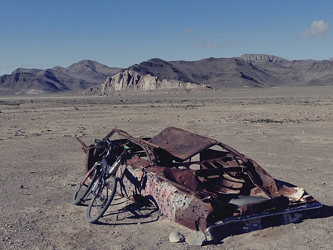 |
 From East. (described
downwards) A sliver of Sevier Lake appears between
the rocks, soon after rolling down the gentle
inclined plain. But in order to get to the lake
you have to keep riding for quite a while. The
flat, white, salty surface shimmers in the
distance. There is a short stretch on this side,
where the surface may justify a mountain bike. But
it does not last.
From East. (described
downwards) A sliver of Sevier Lake appears between
the rocks, soon after rolling down the gentle
inclined plain. But in order to get to the lake
you have to keep riding for quite a while. The
flat, white, salty surface shimmers in the
distance. There is a short stretch on this side,
where the surface may justify a mountain bike. But
it does not last.|
|
advertisement |
|
|
advertisement |