| |
| |
Marjum Pass I15 marks is a de-facto
scenic boundary in Utah. All of the well
known "attractions" are east of that
highway. West of here lies the Great
Western Dessert, a fascinating relatively
unpopulated landscape with classic dessert
basin and range landscape, that stretches
into Nevada. This part of Utah could pass
for Nevada any day. Marjum Pass is one of
two gravel passes in the House Range, the
eastern most and the most spectacular
range of the great western dessert of
Utah, that is also fairly easy to access. The route over the top,
between points 4 and 6 follows the old
Hiway 6 and 50 routes. The lower parts of
the profile are constructed from
convenient access routes from the modern
Hiway 6
From West. The strike slope is a lot more interesting, and the name House Range begins to make visual sence. As the road carves into the rocks, the towers do resemble modern high rise housing blocks, a little more irregular maybe - a kind of futuristic Barcelona look. Much of this comes from the stratified look of the limestone: Back to the city block comparisons: here we don't have to put up with all that traffic or the people. The name actually does have its origin from this resemblance. It was named by Captain H J Simpson, when he passed through here on his way back from California in 1859 because it reminded him of "outline to domes, minarets, houses and other structures". The downhill on this side has a short stretch of deep gravel that would be difficult to ride uphill. I think the most dramatic
location though is actually in front of the
House Mountains, near the low point on this
side and at a major, totally unsigned
intersection. But who needs signs in a grid
pattern world like this, where ranges run
north - south. This intersection is kind
enough to be at right angles. From here the walls up to
Notch Peak make their most dramatic
appearance. In terms of pure numbers, this
vertical drop is said to be the 2nd highest
in the US, after El Capitan in Yosemite
Valley. It is also one of the highest
limestone cliffs in the world. Looking
around, far ranges to the north are
foregrounded with splashes of white salt,
and powerlines are a study in vanishing
points.
Dayride with this point
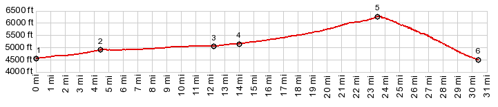
as highest summit: PARTIALLY PAVED / UNPAVED ( | US6 Summit: Tule Valley - Ferguson Dessert > ) Marjum Pass , Skull Rock Pass : 2.8 miles on unsigned road connecting US6 with old US6 just north of Sevier Lake > that road west > old US6 north > Long Ridge Reservoir Rd north > Old US6 west > Marjum Pass > Tule Valley Rd south > US6 east > Skull Creek Pass > Old US6 north > back to starting point on road between US6 and Sevier Lake: 63.8miles with 3030ft of climbing in 6:00hrs (garmin etrex30 m3:22.4.14) Notes: I met exactly 1 car/truck on the unpaved part. Naturally they stopped to check on me.  |
|
|
advertisement |
|
|
advertisement |