| |
|
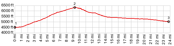
1.START-END EAST:US6 low point in Tule
Valley at a dry stream crossing
2.TOP, 6280ft
3.START-END WEST:US6 low point in Ferguson Dessert
|
|
1.START-END EAST:US6 low point in Tule
Valley at a dry stream crossing
|