Niotche Lost Creek Divide
The Sevier Plateau is ATV rider territory. I never
saw another cyclist on my rides in this area. It's a
shame. This is large area, enough room for
everybody, and it has many scenically fascinating
riding possibilities, including some very big
climbs, like this one.
click on profile for more detail
|
1.(5160ft,mile00) START-END
NORTH: Salina, jct: US50 - US89
2.(5310ft,mile02) profile turns east onto
I70
3.(5750ft,mile09) profile exits I70 and
turns up Gooseberry Road
4.(6500ft,mile13) Soldier Canyon Road
joins from left
5.(7910ft,mile18) Gooseberry work center
and campground
6.(9170ft,mile23) turnoff to Cold Spring
7.(10550ft,mile28) TOP: Niotche - Lost
Creek Divide
8.(9940ft,mile31) turnoff to Daniel's Pass
on left
9.(8850ft,mile38) profile turns left at
Johnson Valley Reservoir
10.(8680ft,mile41) intermediate low point,
crossing Fremont River
11.(9060ft,mile42) intermediate high point
12.(7720ft,mile48) intermedate low point
at Mill Meadow Reservoir
13.(8080ft,mile51) profile turns left
towards Fremont at this intermediate high
point
14.(7230ft,mile56) Fremont
15.(7060ft,mile61) START-END SOUTH: Loa |
Approaches
From North. The profile starts in Salida
and follows I70 to the Gooseberry Road exit. There
is also a dirt road next to I70 on the south side.
But getting to it involves dropping the bike down
a 6 foot embankment through a slot in the fence.
Gooseberry Road is a monumentally wide road, with
little to no traffic. It is paved until several
hundred feet above point 5, the Gooseberry work
center. Here parking lots, that could accommodate
crowds of super walmart shoppers, wait for
snowmobilers and ATV riders. Apparently it is not
always as peaceful and quiet here, as when I was
there at the end of May. The view is still of
gentle green hills. Only Mount Terril (11531ft)
shows a hint of rock outcrops at the horizon.
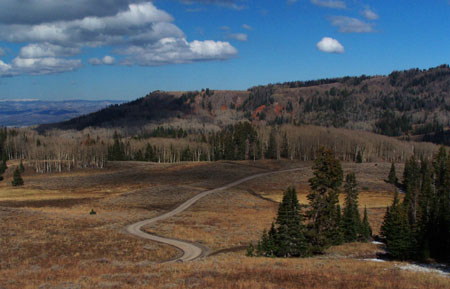
When the road turns to dirt, it does not get any
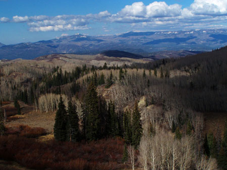
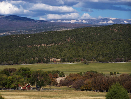
narrower. The pictures below are from a past trip.
During my last ride I discovered, that the idyllic
little dirt road at the top has been replaced by a
bomabastuous embankment that steeply forces its
way to the top through thick gravel. The profile
still shows the old road. It lies buried beneath a
mountain of road construction.
From South (also described upwards).
There are several ways to approach Johnson Valley
Reservoir, point 6. For the profile I picked a
road up from Loa, but making a loop ride either to
the east or west from here involves other roads.
From Johnson Valley Reservoir the road follows a
gentle dip in the Sevier Plateau upwards. Mount
Terril shows its most rocky side from this angle.
On the west side Daniel's Pass, also offers
another way back down.
Dayrides.
PARTIALLY PAVED/ UNPAVED:
Niotche - Lost Creek Divide, Hogan Pass , Meadow
Gulch Divide : short distance south of
Fremont Junction > Ut72 south > Hogan Pass
> FR36 Gooseberry Fremont Rd north > Johnson
Valley Reservoir > Niotche - Lost Creek Divide
> down Gooseberry Road > I70 east >
Meadow Guch Divide > back to starting point: 98
miles with 8500ft of climbing in 8:1hrs.
( < FR004
Water Hollow Rd s(u) | FR150-290
Mary's Nipple(sh) > )
Niotche - Lost Creek Divide x2: short
distance south of I70 Gooseberry Road exit 61 >
up Gooseberry Rd > Niotche Lost Creek Divide
<< turnaround point 310ft below summit, off
road (acc to altimeter measurement) > back over
Niotche Lost Creek Divide > down Gooseberry Rd
> down FR37 Soldier Canyon Rd > I70 service
road east > back to starting point: 49.6 milesw
with 5580ft of climbing in 5:23 hrs (VDO MC1.0
m5:13.5.31).
Notes: turnaround due to snow. Even if the
summit had only patches of snow, there was more
snow south of the summit.
Niotche
- Lost Creek Divide
Highest Point: 10550ft
|
Northern Approach: |
|
|
drop |
from Salina: jct US50 - US89
(5160ft) |
5390ft |
27miles |
|
Southern Approach: |
|
|
|
from Loa (7060ft) |
3490ft |
33+1/2miles |
~1000ft
|
back to
cycling Utah's summits and passes
|