| |
|
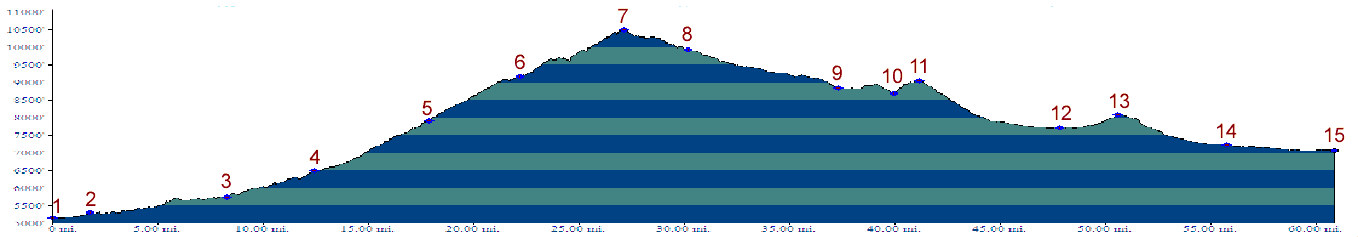
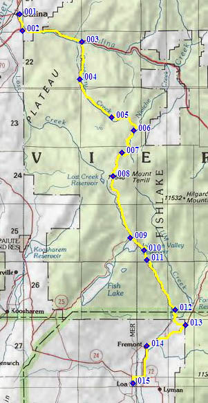
1.(5160ft,mile00) START-END NORTH: Salina, jct: US50 - US89
2.(5310ft,mile02) profile turns east onto I70
3.(5750ft,mile09) profile exits I70 and turns up Gooseberry Road
4.(6500ft,mile13) Soldier Canyon Road joins from left
5.(7910ft,mile18) Gooseberry work center and campground
6.(9170ft,mile23) turnoff to Cold Spring
7.(10550ft,mile28) TOP: Niotche - Lost Creek Divide
8.(9940ft,mile31) turnoff to Daniel's Pass on left
9.(8850ft,mile38) profile turns left at Johnson Valley Reservoir
10.(8680ft,mile41) intermediate low point, crossing Fremont River
11.(9060ft,mile42) intermediate high point
12.(7720ft,mile48) intermedate low point at Mill Meadow Reservoir
13.(8080ft,mile51) profile turns left towards Fremont at this intermediate high point
14.(7230ft,mile56) Fremont
15.(7060ft,mile61) START-END SOUTH: Loa