| |
| |
FR221 Uinta Mountans s(u)
FR221 runs along the north side of
the Unita Crest through gentle hills and meadows.
The straight road is far above the dessert valley
floor, and also far from the linear ridge line
line. This is a great way to get away from the
summer heat, but not the dust.
After the jct with the road to Long Park
Reservoir (another possible summit point on
FR221), it becomes apparent that the road has
climbed gently in relation to the snowline on the
rounded loaves of mountains, that are the Uinta
Crest. But more and more of the view becomes
obscured by forest. The road crests without great
views or any curves, soon after the junction to
Spirit Lake. This is where most of the trailer
trains with other motor vehicles in tow are
heading, surrounded by large clouds of dust. 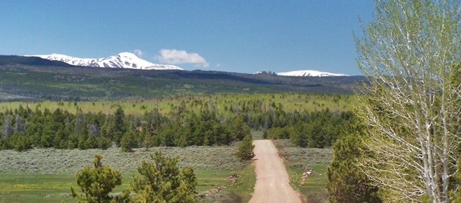 From West. (described
downwards). A steep, fast, featureless canyon
heads north. The most interesting moment comes,
when I spot an old camouflaged train car in a
private yard next to the road. When the road exits
the mountains it becomes paved, only to turn to a
thick gravel for the last miles before hitting
pavement at the jct with Wy-414 Dayride with this point as highest summit: ( < FR221
Sheep Creek - Long Park | Bald Mountain
Pass > ) FR221 Uinta Mtns s(u) , Sheep Creek
Canyon s(u) , Ut44 Manila - Sheep Creek
s(u) : near jct FR221 - Sheep Creek Canyon
> FR221 west > FR221 Uinta Mtns s(u) >
FR1652 north > Wy43 west > Ut43 west >
Manila > Ut44 south > Ut44 Manila - Sheep
Creek s(u) > up Sheep Creek Canyon > Sheep
Creek Canyon s(u) <> out and back down east
side to jct with Ut44 >> back to starting
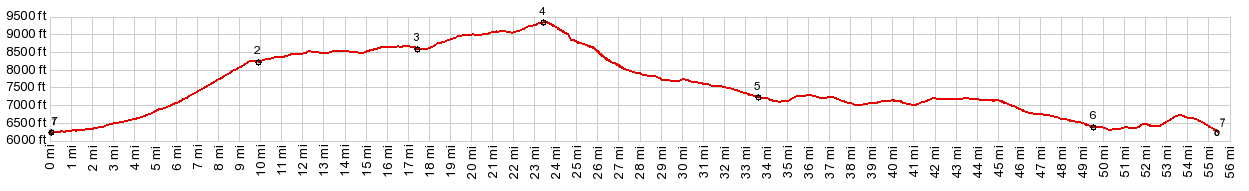
point on FR221: 62.4miles with 5420ft of climbing
in 6:07hrs (garmin etrex30 m5:17.06.04) 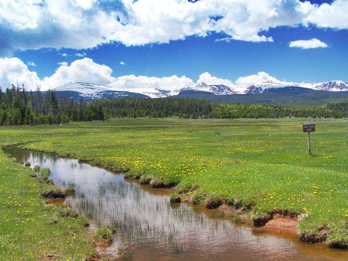 |
|
|
advertisement |
|
|
advertisement |