| |
|
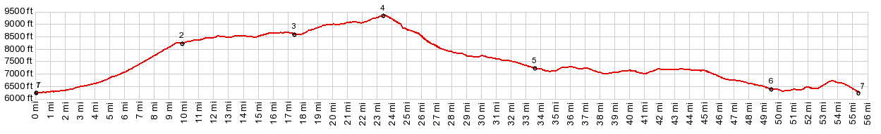
1.(00.0m,6230ft)START-END EAST-1: jct Ut44 - Sheep Creek Canyon
2.(10.0m,8240ft)profile turns left onto FR221
3.(17.4m,8620ft)turnoff to Long Park reservoir is on right; profile continues straight
4.(23.6m,9360ft)TOP
5.(33.6m,7230ft)route joins Wy414 to Manila
6.(49.5m,6380ft)jct Ut43 - Ut44, Manila
7.(55.3m,6290ft)START-END EAST-2 same as point 1
|