| |
| |
FR168 Mill Hollow s(u)
Many years after I was no longer
living in Logan, I met somebody from there, who
told me of his attempts to find a new ride up
Logan Peak every so often. This made me feel as
though I had missed something when I lived there.
I loved hiking and climbing the peaks in the Bear
River Range. But I never mountain biked there. So this was my first attempt at a
mountain bike loop ride, that includes Logan Peak.
I missed the peak by several miles, though I got
fairly close in elevation, but not in the views.
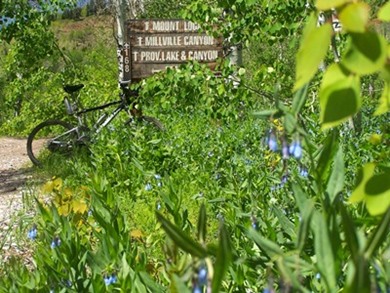
The road seems to crest at a pass where a limited view of Cache Valley opens up. Climbing the surrounding knolls improves the view a little.This summit has a few roads converging on it, and figuring out what goes where can be confusing, especially if most options are covered with snow. I decided to take FR168, which showed the most promise of making this into a loop. Even though the road climbed less than 100ft to its highest point near Mill Hollow, it involved a lot of time carrying the bike over snow and trees across the road
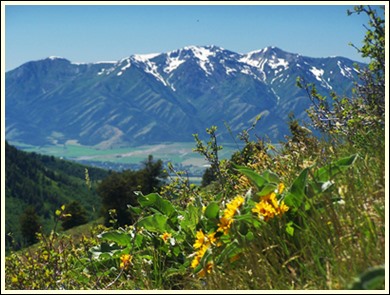
From East. (described downwards). .The descent starts out innocent enough - one more quick five minute hike to climb a ridge and take a picture of the Wellsville Range - but oh what torture followed. The nice dirt road turns into a path of snow bridges over Providence Creek, and that was the good part. The bad part follows as what can only be described as an inclined raingutter full of rocks. Biking totally impossible - walking only with great difficulty - your average destroyed atv trail. There must be a better way down. Gun shots from below tell me that that some form of motorized vehicles are near. So far I haven't seen any since Logan Canyon. The gun range is at an old quarry, and from here
a fast dirt road descend leads into Cache Valley:
one of several roads named "Canyon Road" this one
in Providence. These descends into Cache Valley
are some of the fastest transitions between wild
mountainscape and civilized suburbia that I know.
And the roads are so wide, you can't help but ride
somewhere far away from the right edge. All the
way over there on the right noone will ever see
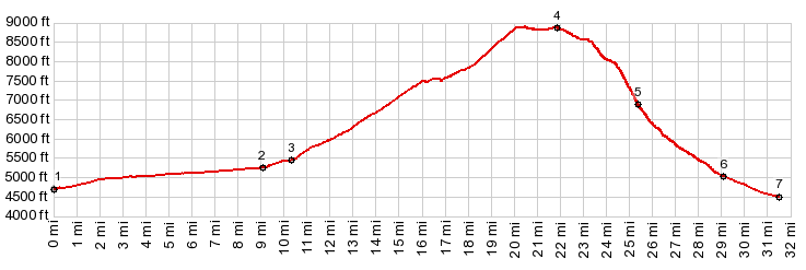
you. A Dayride with this point as highest summit: PARTIALLY PAVED / UNPAVED ( < FR007
Temple Fork s(u) | Galena Summit
> ) FR168 Mill Hollow : short distance up
Left Hand Fork Rd > up Left Hand Fork Rd >
up FR52 > up FR160 > up FR168 > FR168
Mill Hollow s(u) > down Providence Canyon >
various residential streets north > USU campus
with detours > up Logan Canyon Rd > back to
starting point on Left Hand Fork Rd: 38.6miles
with 5180ft of climbing in 6:16hrs (garmin etrex30
m5:17.6.19)
|
|
|
advertisement |
|
|
advertisement |