| |
|
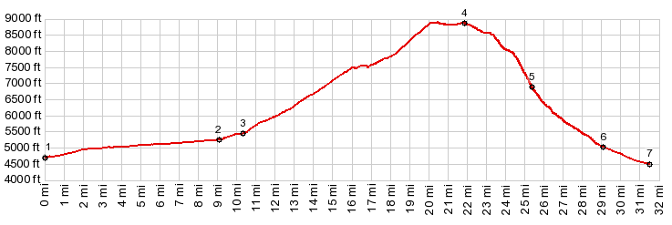
1.(00.0m,4720ft)START-END NORTH: low point on US89 before entering Logan Canyon
2.(09.0m,5240ft)profile turns up Right Hand Fork of Logan Canyon
3.(10.4m,5440ft)profile turns right onto FR52
4.(21.9m,8850ft)TOP
5.(25.4m,6960ft)jct with road to Temple Baldy
6.(29.0m,5180ft)Providence Canyon Rd exits into Providence
7.(31.4m,4410ft)START-END SOUTH:jct Main St - 300 south, Providence
|