| |
| |
Mc Kinney Tanks Summit As US6 decends from Tonopah and
crosses Ralston Valley, it passes a sign
stating "next gas 100some miles" (the some
is a number but I forgot it). This is the first
of at least 5 named summits that US6 hops over
in its route east to Ely. Judging from my own
experience (in my case in late April / early
May), the wind can be a much bigger factor than
the climb during a bike ride.
Approaches I find the views to the south awe
inspiring. The range ends in a few outcrops,
before the eyes enter the vast noman's land of
Cactus Flats. This land is part of the Nellis
airforce base. The summit is signed and labeled
with elevation. 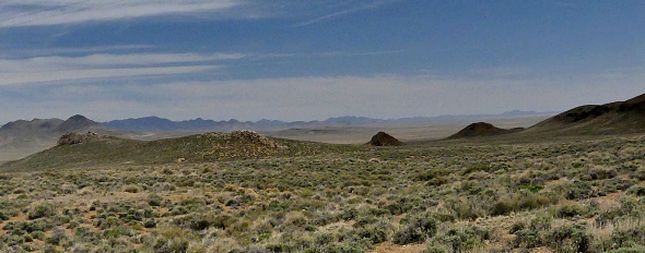
From East. (described
downwards). A short decent leads to an attractive
rest area, located almost at the low point between
this summit and the next one to the east. It's a
good camping or parking base for exploring the
area. 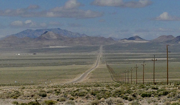
Dayride with this point as
highest summit:
COMPLETELY PAVED ( < Saulsbury Summit | FR14 Manhattan s(u) > ) Mc Kinney Tanks Summit x2 , US6 Tonopah(sh) : Saulsbury Wash Rest Area <> US6 east <> Mc Kinney Tanks Summit(sh) <> US6/I95 north <> Tonopah with several sight seeing detours << turnaround point on I95 at ~5600ft: 57.2miles with 3370ft of climbing in 5:13hrs (garmin etrex32x r4:23.5.2) Notes: very strong wind from south, especially on way back |
|
|
advertisement |
|
|
advertisement |