| |
| |
FR14 Manhattan s(u) This is very isolated country. And
so, the presence of the old mining town, named
Manhattan no less, comes as a surprising
sign of human presence on this route to the
first time visitor. It may well be the only sign
of life you will encounter on the profiled
route. The loop ride below connects these
endpoints of the profile with a regular Nevada
highway with regularly heavy Nevada traffic. This gravel road has a very bicycle friendly surface. It takes advantage of a low gap in the Toquima Range, north east of Tonopah.
But it's still morning and the legs
feel fresh. The turnoff onto FR14 is signed as
going to Manhattan. It looks like a short uniform
climb up an alluvial fan, and that's the end. But
of course it is not. This side has a perfect
surface for a gravel climb. By the time I approach
the summit the surroundings change, It feels nice
to be surrounded by juniper trees once again. But
I have to admit to myself, the views were actually
better down in the treeless valley. From the
summit a short spur leads up the ant hill to the
south. In the distance snowy plateaus seem to be
at eye level. The top is well defined and a view
opens into Big Smoky Valley. But it is not until
much further down, that these mountains on the
other side show off their best side.
From West. (described
downwards). This side seems to have a few short
sandy stretches - but not a problem going
downhill. Pavement starts in the old settlement of
Manhattan. Like so many old mining towns, an
additional new type of miner also moved here,
modern residents living in mega trailers or modern
frame houses. But here it seems to make a good mix
with the old delapidated mining shacks, dry good
stores and car wrecks. On this last part of the paved
decent the best views show up: Big Smoky Valley
and Mahagony Mountain. On FR14, below Manhattan I
saw exactly one vehicle, a delivery vehicle making
a run into Manhattan.
Manhattan Slideshow
Dayride with this point as
highest summit:
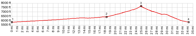
( < McKinney Tanks Summit | FR26 Powell Canyon s(u) > ) PARTIALLY PAVED / UNPAVED FR14 Manhattan s(u) , Nv376 Ralston Valley - Big Smoky Valley s(u): jct Nv376 - Belmont Rd > Belmont Rd north > FR14 east > Manhattan > Nv377 east > Nv376 south > Nv376 Ralston Valley - Big Smoky Valley s(u) > back to starting point at jct Nv376 - Belmont Rd: 58.4miles with 3060ft of climbing in 6:24hrs (garmin etrex32x 23:5.3) Notes: most difficult part was the return back south with constant, extremely strong headwinds. Along the way, the return ride into the wind also went over the shallow Nv376 summit, which has great far views of the Mahagony Mtn area. 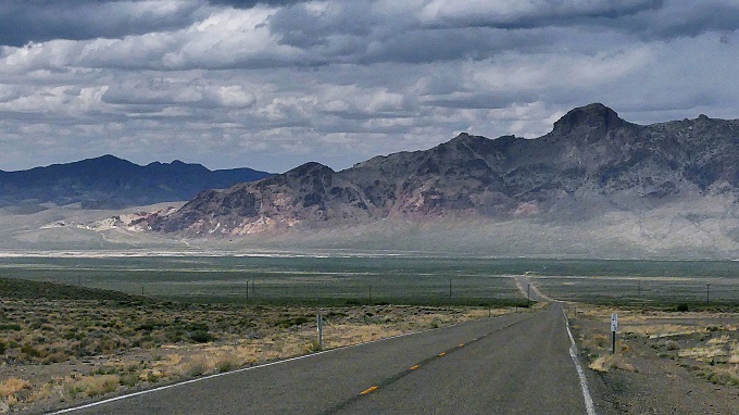 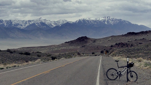 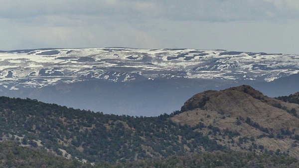 |
|
|
advertisement |
|
|
advertisement |