| |
| |
US6 Tonopah(sh) Tonopah is a kind of American
version of a hilltown in the dessert. Three
major roads converge here, and all of them have
to travel uphill to meet here. The official
Tonopah Summit on maps refers to the point on
I95 immediately south of the town. This point at
the junction of US6 and I95 is very close. But
location and elevation are different enough to
consider it a different point.
Approaches Looking around Tonopah, I have never
seen so many burned down trailers and houses, that
have never been cleaned up. Or have these been
burned down on purpose ? 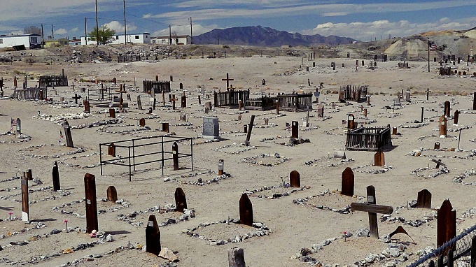
From South. (described
downwards) Immediately after the high point the
road descends a short distance and merges onto two
laned I95. Taking a left here and climbing another
several dozen feet leads to the official Tonopah
Summit. The profile goes right and follows the
main street through Tonopah. One of the more interesting points in Tonopah I found is the cemetery. It adjoins the west side of I95, jammed between the Clown Motel and several leftover trailer wrecks, and a few other structures that once housed something. "Come discover the history of our permanent residents" states a tourist pamphlet in a gazebo. From here you have a great version of this unusual view, overlooking regularly spaced wooden crosses over an acre of dirt. At the end of town, a truck stop
chain is building a large gas station complex, in
the attempt to make this unique town a bit more
like all the others, that line Interstate highways
in deserted areas. On the bike the next thing that
happens, is another gigantic alluvial fan decent
into Big Smoky Valley. Unfortunately the shoulder
is rumble stripped down the middle, soon after the
road crosses the county line. This completely
ruins an up to now great ride. From here on a ride
on I95 is very dangerous for bicycles. I was also
the only one on a bicycle in Tonopah during my
visit. "All the other guys have motorcycles"
commented a woman, in a funny sardonic way" while
I ate my lunch on a town bench. "Yes - I noticed" 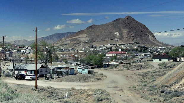 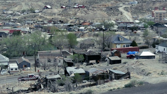 |
|
|
advertisement |
|
|
advertisement |