| |
| |
US Hill summit
US Hill summit connects the
dessert scenery of the Rio Grande Valley south of
Taos with a high, bowl shaped valley in the Sange
de Cristo Mountains. The higher approach leads up
from the Rio Grande drainage. The small side
belongs to a green valley near the Picuris Pueblo,
where several other such lop sided summits
converge. The scenery along the ride is evergreen
forest most of the way, except the part
where the route dumps the cyclist into the dessert
surrounding the Rio Grande gorge. The most
interesting feature during my last traversal were
the elaborate memorials to the dead, visible from
the roadside, and much more clearly visible form a
bicycle than from a car, in my opinion. The summit
is identified in the appendix of Marshall
Sprague's book "the Great Gates".
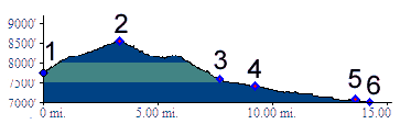
From South. The profile begins where Holman Hill summit ends, a junction of three roads and an abandoned bridge. US Hill starts climbing into a crease in the landscape. The scenery is pleasant trees, but rather eventless, with at last a meadow approaching the top. The road heading west from the summit makes an interesting MTB ride. From North. (described downwards)
Immediately after the summit a large dirt parking
lot beckons to stop and look at the scenery. But
the Sangre de Cristo Mountains are still largely
obscured by trees. There is a better spot further
down. Many miles further down something mysterious
happens. Shortly after the junction with FR438 the
road becomes signed as bicycle route, marked by
extremely high signs. The luxurious shoulder, very
rare for New Mexico standards, continues all the
way to Talpa.
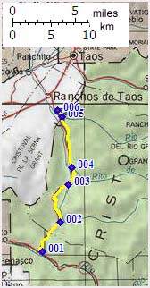
PARTIALLY PAVED / UNPAVED ( < FR639
Truchas Peaks s(u) | NM4 Valle
Caldera s(u) > ) US Hill Summit x2 , NM76 Trampas - Chamisal
s(u) : several miles west of Rio Lucio
along NM75 > NM75 west > outskirts of Dixon
> NM580 east > CR69 east > Ojo Sarco >
NM76 north > Las Trampas > NM76 Trampas -
Chamisal > Chamisal > jct with NM75 <>
out and back NM75 east > Penasco > Us Hill
Summit <> turnaround point 650ft below
summit at jct with FR273 >> Rio Lucio >
back to starting point along NM75: 58.2miles with
5590ft of climbing in 5:29hrs (garmin etrex30
r4:21.6.7). A Dayride with this point as intermediate
summit is on page: Holman Hill Summit 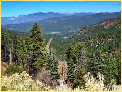 back to
New Mexico's Summits and Passes by Bicycle |
 Approaches
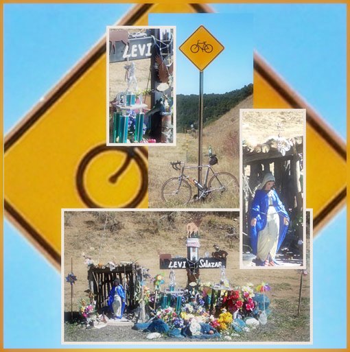 Dayrides with this point as
highest summit point:
Dayrides with this point as
highest summit point:|
|
advertisement |
|
|
advertisement |