| |
| |
FR639 Truchas Peaks s(u) The Truchas Peaks are a few
outlying peaks of the southern Sangre de
Cristo Mountains. They reach above
treeline, and could easily be mistaken for
peaks in Colorado. This jeep road passes
two trailheads into the area and passes
two nice views of these impressive
mountains. But the route still stays low
in the foothills.
It's not all as steep as the
first 100 yards. Soon the rutted but smooth
road levels out a bit, and one of exactly
two good views of the Trampas Mountains
appears framed by trees. A junction meets a road, which
can be used as alternate approach, leaving
pavement of FR72 near the FR72 Truchas
summit. After the second interesting view
the road gains the forested ridge. At the
top spurs continue climbing in both
directions.
From
East. (described downwards) A fast
decent leads past a trailhead to the jct
with the much wider FR207. But first Rio de
las Trampas has to be crossed - wet legs are
better than a submerged derailleur. FR207 is a long,
straight-as-an arrow, shallow decent back to
a junction with NM72. The road has one or
two rocky stretches. El Valle Rd leads past
a cemetery that was established in the 1750s
(according to the sign) and a mixture of
modern retirement farms and wooden steeples,
speaking of colonial remnants 
Dayride with this point as
highest summit
PARTIALLY PAVED / UNPAVED ( < NM76 Truchas s(u) | US Hill Summit > ) FR639 Truchas Mtns s(u) , NM76 Truchas s(su) , NM76 Trampas s(u) , additional out and back: jct FR639 - FR667 > up FR639 > FR639 Truchas Mtns s(u) > down FR639 with small out and back detour <> jct with FR207 el Valle Rd <> out and back to end ofr FR207 at Truchas trailhead >> down FR207 > NM76 east <> out and back to end of Vallecito Rd , including several short spurs >> NM76 west > NM76 Truchas s(u) with several short detours in Ojo Sarco area > Truchas > back to starting point at jct FR639 - FR667: 41.4miles with 4220ft of climbing in 5:13hrs (garmin etrex30 m5:21.6.2). |
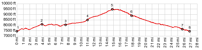
 The profile climbs
on pavement over the NM72 Truchas summit,
arriving at the village at the edge:
Trampas. Turning left and going through the
village you pass the Trampas mission (built
in 1752) and more buidlings that are
wonderfully un American. The county road
turns into a forest dirt road, and at the
next junction FR639 - FR667 the route stays
left and the climb really starts.
The profile climbs
on pavement over the NM72 Truchas summit,
arriving at the village at the edge:
Trampas. Turning left and going through the
village you pass the Trampas mission (built
in 1752) and more buidlings that are
wonderfully un American. The county road
turns into a forest dirt road, and at the
next junction FR639 - FR667 the route stays
left and the climb really starts.|
|
advertisement |
|
|
advertisement |