| |
| |
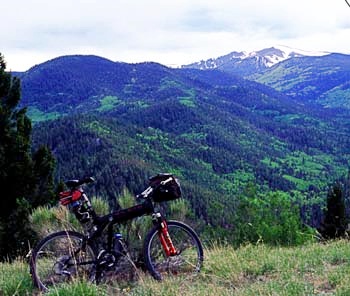
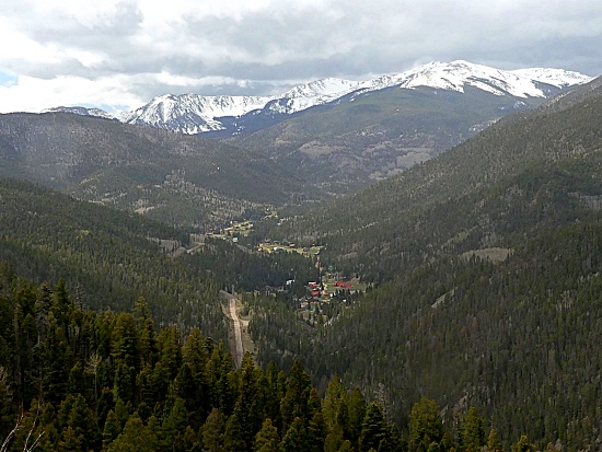
Red River Pass s(u)
Red River Pass was the highway
crossing over the Sangre de Cristo Mountains
before it was replaced by Bobcat Pass.
Considering how close the two passes are, the
differences are amazing. Seeing the shelf road
across the top of Red River Pass, it becomes clear
that Bobcat Pass must be easier to maintain in
winter.
 Looking on
a map, there are actually four roads that meet on
top of Red River Pass. But looking at it in
reality, two of these roads are private roads.
Using the two public approaches, the route
actually reach a higher elevation than the pass
itself on the eastern approach to the pass. This
new approach connects to the top of Bobcat Pass.
The original eastern approach of the old Red River
Pass highway is now on gated private land. Looking on
a map, there are actually four roads that meet on
top of Red River Pass. But looking at it in
reality, two of these roads are private roads.
Using the two public approaches, the route
actually reach a higher elevation than the pass
itself on the eastern approach to the pass. This
new approach connects to the top of Bobcat Pass.
The original eastern approach of the old Red River
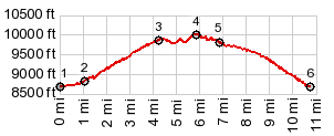
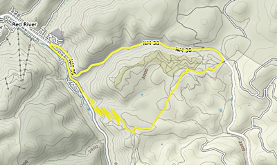
Pass highway is now on gated private land.The two public road approaches can be made into a short 2 to 3 hour loop ride from Red River, and that is the only part shown on the profile. The lower approaches on each side are on the Bobcat Pass profile.
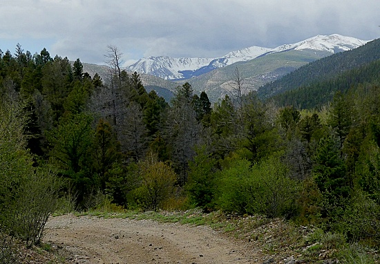
Approaches From West. On the western edge of Red
River the road to Bobcat Pass
starts getting steeper. But NM38 towards "Bull of
the Woods" continues going through the woods like
a cow, rather than a bull. That is the way the
profile goes. The jct to Red River Pass Road onto
FR488 is actually signed.
The public option makes a 90 degree left turn and
continues to thread between fences and no
trespassing signs. At another forced 90 degree
turn in the forest, a sign reads "dead end". This
is clearly a lie. The road goes through. The road
is now a not-too-rough jeep trail, better mountain
bike territory than gravel bike. Two more unsigned
junctions make the route a little confusing. I
stayed right (that is uphill) on the first one,
left or downhill on the second. But I suspect they
all reach NM578. The highest point is somewhere on
this forested route.
Dayrides with this point as highest summit: ( < Bobcat
Pass | US64 Tres
Piedras - Tierra Amarilla s(u) > ) Red River Pass s(u) , additional out and back
: a short distance up FR488 towards Red River
Pass from Red River > up FR488 > Red River
Pass s(u) > down public road approach >
Bobcat Pass(shp) <> out and back on
residental road to point of closure at about
10000ft >> Red River > up NM578 > jct
with FR488 <> out and back to end of
pavement <> out and backon Wheeler Rd to
East Fork trailhead[unp] <> separate partial
out and back on FR79 towards Bull of the Woods
Trailhead >> back down NM578 > back to
starting point on FR488: 28.0miles with 3340ft of
climbing in 3:46hrs (garmin etrex30 m5:21.5.22) ( | Taos Boundary Trail s(u) > ) Red River Pass , Osha
Pass , additional out and back: Taos
area > US64 west > Valle Escondido
> a variety of confusing logging roads towards
Osha Pass > Osha Pass > more confusing
tracks down the west side > Angelfire > US64
north > Eagles Nest > Bobcat Pass(shp) >
forest road east > Red River Pass > down
FR488 <> out and back up NM578 to Bull of
Woods area, looking for a connection to Rio Hondo
Canyon to Taos >> Red River > down NM38
> Questa > NM522 south > back to starting
point in Taos area: 110miles with 8210ft of
climbing in 9:5hours (r3:5.6.10)
back to
New Mexico's Summits and Passes by Bicycle |
 A steep set of switchbacks winds
up the side of the mountain with ever improving
views onto a shoulder of Mount Wheeler and to old
Bull of the Woods Road below. The road reaches a
junction with two other gated roads at what looks
like a pass. During my first visit there was a
sign here naming this "Old Red River Pass"
complete with elevation. During my last visit this
was no longer here.
A steep set of switchbacks winds
up the side of the mountain with ever improving
views onto a shoulder of Mount Wheeler and to old
Bull of the Woods Road below. The road reaches a
junction with two other gated roads at what looks
like a pass. During my first visit there was a
sign here naming this "Old Red River Pass"
complete with elevation. During my last visit this
was no longer here. From East.
(described downwards) A short decent leads to
what looks like a ranch. This is one of those
typical anxious moments of mountain biking in
America. Are there gates ? Is there a narrow strip
of private land between here and the highway
visible closeby on my gps ? Actually the ranch
itself is not a ranch but the ATV rental place on
top of Bobcat Pass, and the bike is on pavement
before realizing where I actually am. The profile
continues on NM38 back down to Red River
From East.
(described downwards) A short decent leads to
what looks like a ranch. This is one of those
typical anxious moments of mountain biking in
America. Are there gates ? Is there a narrow strip
of private land between here and the highway
visible closeby on my gps ? Actually the ranch
itself is not a ranch but the ATV rental place on
top of Bobcat Pass, and the bike is on pavement
before realizing where I actually am. The profile
continues on NM38 back down to Red River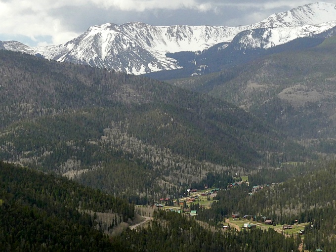
|
|
advertisement |
|
|
advertisement |