| |
| |
Like its neighboring state
to the west, the topography of New Mexico
changes radically from north to south. And
so - what just may be the highest paved road
in New Mexico is actually a fairly gentle,
little visited road over a rolling plateau,
named Tusas Ridge. Just to the north, across
the boundary in Colorado are many higher
highways through rugged mountains. But here
a sweeping, desolate landscape waits to be
cycled. The feeling of isolation is
heightened by the restrictive land use in
the Tierra Amarilla landgrant area.
Tres Piedras is a collection
of trailers and houses scattered in the
woods with a single business: a restaurant
and bar. It sits on the exact dividing line
between the rolling dessert plateau around
the Rio Grande Gorge and the forested Tusas
Ridge to the west. Between here and the summit
the road only gains ~2000ft in elevation.
But the rolling landscape contains two
intermediate high points. I count the first
one as a summit (max - min elevation is
greater than 500ft). There are additonal
unpaved roads on the map for the second,
higher one to also meet that criteria. But
they are inside the Tierra Amarilla area and
probably closed to public travel.
Just before crossing into the
Tierra Amarilla area the road first reaches
a gentle high point in a high meadow with a
parking area, deserving of a summit, only to
drop again and finailly arrive at the
escarpment. Super luxurious picnic tables
along a single scenic rock outcrop,
overlooking the sweeping valley, mark the
view The highest point is reached just at
what looks like a switchback on the map, but
is really a large radius curve, making a
perfect highlight over the ridge.
From
West. (described downwards). It is
fairly rare that you can just let the bike
roll down full speed. The road surface is
sufficient, the road is wide and contains
only large radius curves - virtually no
traffic - little reason to stop in ths wide
sweeping landscape, where distant features
only move slowly while the bike moves at top
speed that still feels save. The land has a strange
abandoned or reserved appearance. Absolutely
all passage ways off the highway are locked
with gates. Eventually even these wide
radius curves turn into a long straight
away. At the end the scattered farms and
houses of Tierra Amarilla dot the landscape.
The most rocky-rugged view along the way is
actually here at the bottom and in the
distance, the peaks between Chama and
Antonito, part of the eastern San Juan
Mountains, for the most part located in
Colorado.
Dayride with this point
as highest summit:
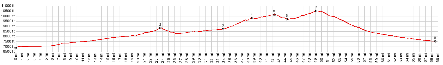
COMPLETELY PAVED ( < Red River Pass | FR222 Petaca s(u) > ) US64 Tres Piedras s(u) , US64 TP-TA s(u) -2 : 3/4 mile west of Tres Piedras <> US64 TP-TA s(u)-2 <> US64 TP-TA s(u)-3(?) <> US64 Tres Piedras s(u) <> turnaround point within view of Tierra Amarilla ~3 miles before reaching it: 92.0miles with 7360ft of climbing in 7:53hrs (garmin etrex30 r4:21.5.25). Notes: a perfect sunny spring day with ideal temperatures along the way. Nice backwind on the return 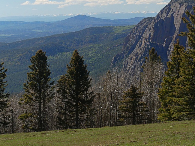 |
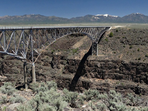 As an aside,
since most of these tourists come from Taos,
the road between the bridge and Taos can be
very busy. It is narrow and has no shoulder
and often it would be a nightmare to bike.
Following the profile up from here, the road
is no wider, but traffic seems much lighter.
Still these first 20 miles between here and
Tres Piedras only has less than a handful of
barely perceptible bends, and climbs as
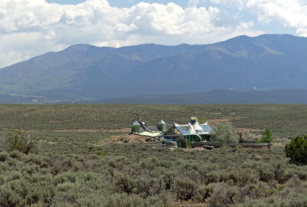
steady as an inclined plane. The one curious
attraction along the road is the earthship
settelement. Self sufficient solar homes
with spaceship like appearance dot the sage
covered plane between the road and Sangre de
Cristo horizon. A good telephoto lens comes
in handy.
As an aside,
since most of these tourists come from Taos,
the road between the bridge and Taos can be
very busy. It is narrow and has no shoulder
and often it would be a nightmare to bike.
Following the profile up from here, the road
is no wider, but traffic seems much lighter.
Still these first 20 miles between here and
Tres Piedras only has less than a handful of
barely perceptible bends, and climbs as
steady as an inclined plane. The one curious
attraction along the road is the earthship
settelement. Self sufficient solar homes
with spaceship like appearance dot the sage
covered plane between the road and Sangre de
Cristo horizon. A good telephoto lens comes
in handy.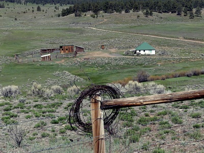 Anyway - a
pleasant ride trough low ravines leads up to
a gentle high, rolling plateau. The
sustained gentle climbing starts at a
ramshackle trailer shack residence greeting
potential visitors with a life sized human
puppet hung above the gate. It ends with the
sight of Hopewell Lake, a gentle blue oval
on the rolling plaiin. Along the way the
Sangre de Cristo Range behind Taos
periodically lurk between the trees. Even
from the top they still make a backdrop.
Anyway - a
pleasant ride trough low ravines leads up to
a gentle high, rolling plateau. The
sustained gentle climbing starts at a
ramshackle trailer shack residence greeting
potential visitors with a life sized human
puppet hung above the gate. It ends with the
sight of Hopewell Lake, a gentle blue oval
on the rolling plaiin. Along the way the
Sangre de Cristo Range behind Taos
periodically lurk between the trees. Even
from the top they still make a backdrop.|
|
advertisement |
|
|
advertisement |