| |
| |
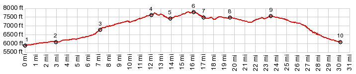
NM76 Chamisal - Trampas s(u) This is a smaller summit on
the NM76
Truchas s(u) route, and contains one
of the most attractive spots along the
route, an old mission church at Las
Trampas. On that profile this point just
shows up with barely a 300ft climb on the
south side. On the north side a series of
rolling hills decend to the Rio Grande
Gorge. So it counts as a summit on that
loop. The profile below uses
another unpaved road to cut off the NM76
Truchas summit, using NM580 - CR69 from
Dixon to Montecito. This can be a
charming, ultra quiet ride, surrounded by
badlands scenery sprinkled with car
carcasses and rusting home appliances of
Ojo Sarco. Looking at the map, Vallecito
Rd may give the appearance of connecting
this summit to the Rio Grande Valley with
a few detours detours. But that road ends
at various collections of ramshackle
trailers and piles of unidentifiable
debris in the dessert.
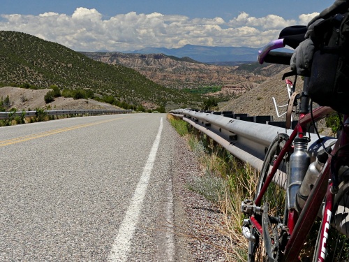
Never fear, the turnoff onto NM75 to Dixon is near and well signed. The road climbs gently into the layer cake geology around the gorge. Dixon seems pleasant enough, even has a bar and something resembling a grocery market - but best of all many adobe buidling scattered between the trailers and rickety fences, dead cars, and collection of objects that once were useful.
NM580 splits off NM65 in what
seems like the last southern scatterings of
Dixon. But there are lots more of Dixon
trailers, old cars, refrigerators, the
occasional winery and Californian resident'
second home along the ample mininature
curves of NM580. NM580 stops at a couple of
parked cars, doubling as garbage dumps. But
just before that, unpaved CR69 starts
climbing into the badland ravines. This is
the most scenic part of this profile, with a
very variable grade and good road surface. On top the first discarded
cars and refrigerators of Ojo Sarco make
their appearance. Many of them are parked in
the shade under big old trees. I'm guessing,
this is so the upholstery does not suffer
too much over the centuries. Some dead cars
are patrolled by stray dogs. There is a fork
in the road at a church. Both optons lead to
NM75. But the left fork is the one in the
profile, which is also shorter. NM75 includes 2 more rolling hills before the last short roll into Las Trampas. The peaceful old mission is a choice spot along this route. It was established in 1751 by 12 families through a land grant. The church itself was constructed between 1760 and 1776. When I visited here the first time the church was open. - Not so since then. A major attraction here is the absence of people in general. 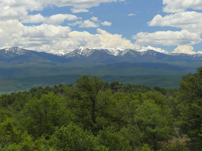
Even though there is a 300ft
decend,I am not counting this as a separate
summit. That is because there is no way to
get a total of 500ft elevation gain on this
side, before climbing to a higher point,
even if it were possible to double back onto
the other approach. An ever so small roll leads into a forested valley. The two haphhazard villages that foreground the snow capped peak are part of the Picuris Pueblo area. Whatever businesses there once were are not open. Whatever roads lead to the pueblo itself say they are closet. Whatever signs there once were that people stopped here - they are gone. It's a shame. It is a very picturesque area. Slideshow of Las Trampas and
the unpaved southern approach
Dayrides with this point
as intermediate summit are on pages:
NM76 Truchas - Trampas FR639 Truchas Mountains US Hill Summit 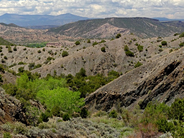 |
|
|
advertisement |
|
|
advertisement |