| |
| |
NM126 Fenton HIll s(u) This is one of three wooded
summits on a a long and lonesome road
through New Mexico forest land, connecting
the Jemez Pueblo area with Cuba. Of course
there is an easier way to connect these
two towns by staying in the valley on
US550. Alternatively, in combination with
NM4
Valle Calderas s(u), you could look
at NM126 as 4 forested summits across the
Jemez Mountains. this profile and map is
included in the NM126
Fenton Lake - Deer Lake page
Approaches From
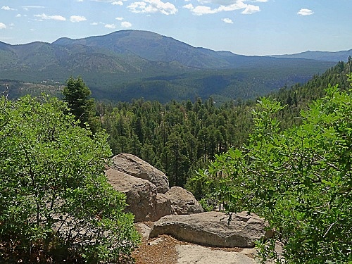
South. (described downwards). After
the gentle summit there is an unmarked
turnoff to an overlook which imparts an
impression of the valley below. Several hundred feet down,
dirt roads divert in both directions
at once. The one on the left goes to a
trailhead on the San Antonio River, leading
to a Hot Spring. On the remaining decent a
NM forest campground has water.
 Dayride
with this point as highest summit: Dayride
with this point as highest summit:( < NM126 Fenton Lake - Deer Lake s(u) | FR578 Hermosa Park Rd s(u) > ) NM126 Fenton Hill s(u) x2, additional out and back: a short distance on NM126 past end of pavement > NM126 south > NM126 Fenton Hill s(u) <> out and back on unmarked closed road to San Antonio Hot Springs trailhead >> NM126 south << turnaround point at jct with NM4 > back over Fenton Hill s(u) > back to starting point on NM126: 39.3 miles with 3200ft of climbing in 4:16hrs (garmin etrex30 m5:21.6.19). Notes: much too hot . Usually i don't include pictures of points that are not on the profile. But this is an ecception. On this long hot weekend day, I actually saw several mountain bikers here, on this sidetrip to San Antonio Hot Spring - amongst them a family covering at least 3 generations ... while at the same time, several males hiked there naked. This strikes me as complete cultural insensitivity.The first subject was definitely more photogenic. - The drop to the river for that sidetrip does not constitute a separate summit ... less than 300ft elevation gain. 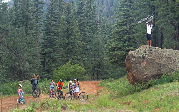 |
|
|
advertisement |
|
|
advertisement |