| |
| |
FR578 Hermosa Park Rd s(u) This small summit is part of
the joint eastern approach from US550 and
the Purgatory Ski area to Bolam Pass and
Scotch
Creek Pass. A sign along the way
points out that the route follows the
Historic Pinkerton Toll Road, which
continues west over Scotch Creek Pass.
Soon a small sign directs
whoever is interested to a good dirt road,
climbing towards the south. The Needles
Mountains gain in stature but their base
remains hidden in the trees. The road leads
to a gentle forested summit with other
forest road turnoffs nearby
Dayride with this point as
highest two way summit
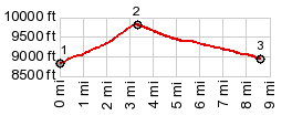
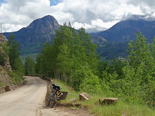
PARTIALLY PAVED / UNPAVED ( < NM126 Fenton Hill s(u) | FR579 Cascade Divide Rd(ow) > ) FR578 Hermosa Park Rd x2 , additional out and back :near FR591 - US550, north of Purgatory Ski area > US550 south > Purgatory Ski area > up FR578 > Hermosa Park Rd s(u) > jct FR550 <> out and back up FR550 towards Scotch Creek Pass with turnaround point at creek crossing at 10080ft <> separate out and back up FR578 towards Bolam Pass with turnaround point at the lake before the summit >> back over FR578 Hermosa Park Rd s(u) > Purgatory Ski area > back to starting point near jct FR591 - US550: 47.6miles with 5940ft of climbing in 6:39hrs (garmin etrex30 m5:21.6.28) 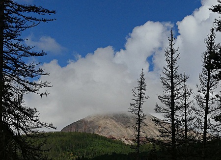 Notes:
not the planned route, but that seems to
be the way it's going this year. Nice
temperatures with finish in cold light
rain. But this is better than the 118
degrees that eastern Washington had today,
or Portland's 112 degrees yesterday. - The
turnaround points were all higher than this
two way summit. Notes:
not the planned route, but that seems to
be the way it's going this year. Nice
temperatures with finish in cold light
rain. But this is better than the 118
degrees that eastern Washington had today,
or Portland's 112 degrees yesterday. - The
turnaround points were all higher than this
two way summit. |
|
|
advertisement |
|
|
advertisement |