| |
| |
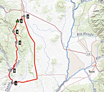
FR222 Petaca(sh) This is a completely
unremarkable summit in the woods of Tusas
Ridge, south of Tres Piedras. The
interesting thing about the loop has
nothing to do with the summit, and it is
something uniquely New Mexican. The road
passes through two remote decaying
villages and their cemeteries, which can
be an interesting photographic subject.
FR222 turns off US285 a short
distance before reaching Tres Piedras. It
passes a few ramshackle trailers and after a
short climb crests unceremoniously in the
forest. At the top an unpaved track leads
higher in both directions, the Tusas Ridge
Rd. From North. The
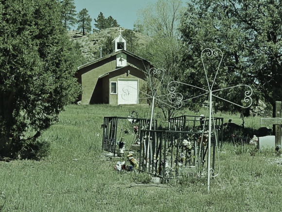
picture below is the cemetery in Las Tablas
- no live people, but I encountered plenty
of dogs. The next town, Petaca shows a few
more signs of live. Soon after that the road turns
paved and a reasonably scenic ravine
descendes to La Madera. A dog there bit me.
I would still call him friendly compared to
Mexican and Latin American dogs. Since then
I carry more rocks on the bike before
entering New Mexico towns ... one more
picture of a memorial in the middle of the
woods after that.
 Dayride with this point
as highest summit:
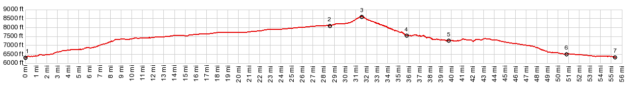
( < US64 Tres Piedras s(u) | NM76 Truchas s(u) > ) FR222 Petaca s(u) : 3/4 mile west of Tres Piedras > Tres Piedras > US285 south > FR222 west > Las Tablas > Petaca > South Petaca > NM519 south > La Madera > NM111 south > US285 north > back to starting point, 3/4 miles west of Tres Piedras: 62.2miles with 3390ft of climbing in 5:40hrs (garmin etrex30 m5:21.6.27) 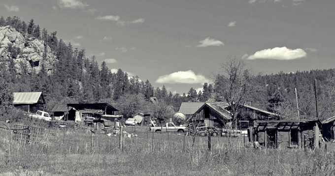 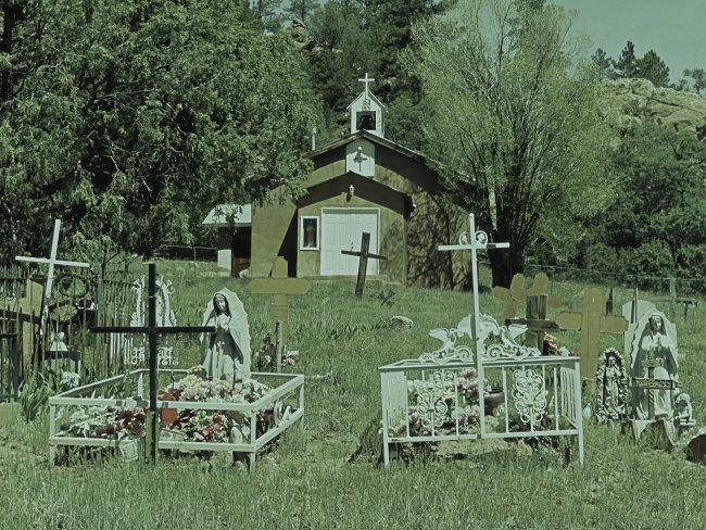 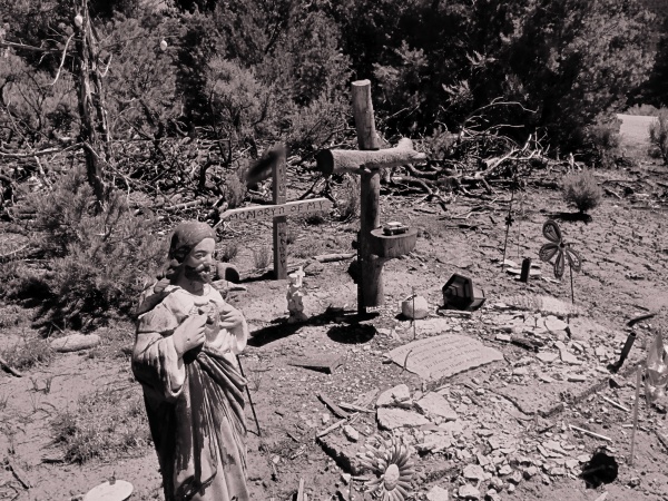 |
|
|
advertisement |
|
|
advertisement |