|
|
|
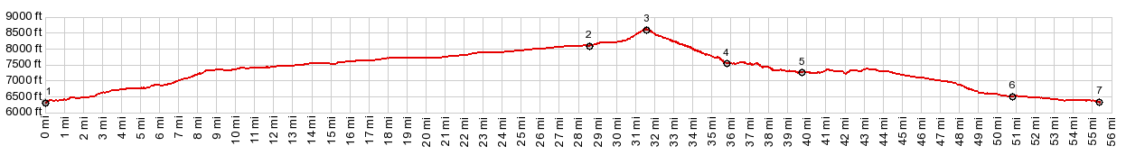
1.START-END SOUTH-1:creek crossing just
north of jct US285 - NM111
2.profile turns left onto FR222
3.TOP: FR222 Petaca(sh) -8600ft
4.turnoff to Las Tablas cemeteru\y
5.Petaca
6.Madera
7.START-END SOUTH-2:sane point as SOUTH-1
|