| |
| advertisement |
| -------- |
| advertisement |
|
FR 76 summit(u) Cerro
Vista
The Sangre de Cristo
Mountains change drastically in appearance
on their scenic, arrow like course, north to
south, from southern Colorado into northern
New Mexico. While the Colorado section
contains a sculpted set of peaks, the
southern part of the range is a maze of
rounded hills, which seen against the light,
look like a succession of roundly cut paper
cutouts. A traversal over FR76 leads along a
principal ridge in the southern Sangre de
Cristo Mountains. Especially the approach
from the east side is pretty long.
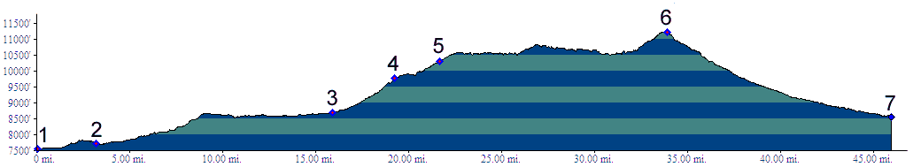
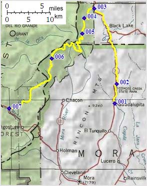
From East. The profile begins from
the small collection of houses named
Guadalupita to show the maximum elevation gain
during a day long loop ride. The description
begins later, where FR076 turns off NM434. The
intersection is signed with a small National
Forest sign from both directions. A little
distance after the turnoff another sign
indicates that Osha
Pass and San Antonio Church Road are
also up this way. A good dirt road soon
becomes a hard dirt matrix containing some
very large rocks, which is a good surface to
climb on, since the rocks stay in place. After
the turnoff to Osha
Pass, the road levels out little bit for
a little rest and relaxation. The turnoff to
the South Boundary Trail, whose lower, very
rough part terminates here is also signed.
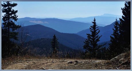
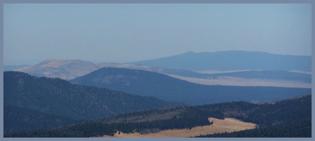
Only once does the dense canopy of trees give
way to open the view onto the drainage of
Cieneguilla Creek, containing the resort of
Angel Fire and Eagle Nest Lake. Long
sweeping curves begin to carve along the
gentle ridgeline, now periodically opening
views onto the eastern highlands, until the
road appears to crest at a small meadow. This
is however the beginning of a long traverse,
the most scenic part of the ride. The
road finally works itself up another 300
feet onto the shoulder of a big, old aunthill
11939ft Cerro Vista himself.
From West. (described downwards). The
road follows Rito Presa Creek all the way and
there are not further far views. The surface
turns rockier for the first part of the
descent, and unlike the other side, here they
are of the loosely-lying-around-on-the-road
variety, which would make climbing difficult.
The situation improves at each junction. But
the road remains loose gravel road all to Tres
Ritos (Oct/7), a georgraphical name that shows
up on some maps, but without human made
facilities. It is located at the junction to
the paved road to Holman Hill
summit.
Tours Dayrides. (MTB+paved): A loop ride from Coyote Creek State Park > NM434 > FR 76 summit(u) > Tres Ritos > Holman Hill summit > Mora > Guadalupita > back to the starting point measuered 84 miles with 6000ft of climbing in 7:4 hours (m3:07.10.27).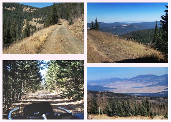
back
to New Mexico's Summits and Passes by
Bicycle |
 Approaches