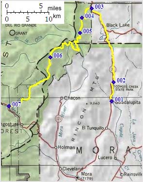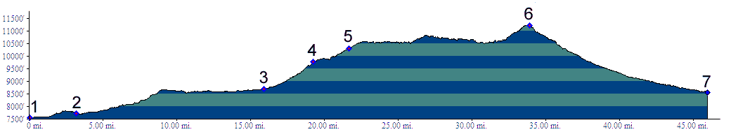
01.(7570ft,mile00) START-END EAST ALT.: Guadalupita
02.(7710ft,mile04) Coyote Creek State Park
03.(8680ft,mile16) profile turns from NM434 left onto FR 76
04.(9770ft,mile20) turnoff on right leads to Osha Pass
05.(10300ft,mile22) turnoff on right goes to FR153
06.(11230ft,mile35) TOP: just south east of Cerro Vista
07.(8560ft,mile46) START-END WEST: FR153 terminates onto NM518 near Tres Ritos