| |
| |
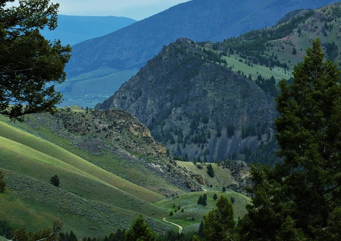
Williams Creek Summit This is a big climb and
quite a workout on a surface suitable for
any gravel bike, maybe even some road
bikes. Too bad it goes mostly through
firewood cutting areas with scenery in a a
state of medium devastation.
From
North. (described downwards) If there
are hardly any interesting views through the
trees on the other side, there definitely
are none whatsoever on this side. After a
short fast decent you have to choose between
Cobalt and Leesburg as destination. Weather
either one actually exist today is a
debatable question. My loop in this area
uses a short somewhat rocky connection road
to connect the two. The profile follows the
Cobalt option down Panther Creek.
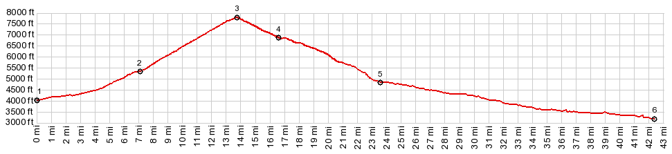
 Dayride with this point as highest summit: COMPLETELY UNPAVED (< FR28 Williams Lake Rd s(u) | FR128 Salmon area s(u) > ) Williams Summit x2 , additional out and back: jct FR28 - Williams Creek Rd > up William Creek Rd > Williams Creek Summit > down north side of Williams Creek Rd > FR242 south > jct with Moccasin Creek Rd <> short out and back continuing on FR242 west >> Moccasin Creek Rd south > Williams Creek Rd south > Williams Creek Summit <> out and back on Phelan Ridge Rd north to turnaround point at ~8000ft >> down south side of Williams Creek Rd back to starting point: 33.6miles with 5040ft of climbing in 4:26hrs (garmin etrex30 m3:20.6.27) Notes: short ride but more than enough climbing on dirt roads |
|
|
advertisement |
|
|
advertisement |