|
|
|
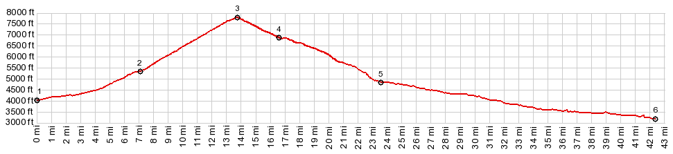
1.START-END EAST:Shoup Bridge on US93
2.jct with FR28 on left
3.TOP,7810ft: Williams Creek Summit
4.jct with Deep Creek Rd on left
5.profile turns right on Panther Creek Rd
6.START-END WEST:jct Panther Creek Rd - Salmon River Rd.
|