| |
| |
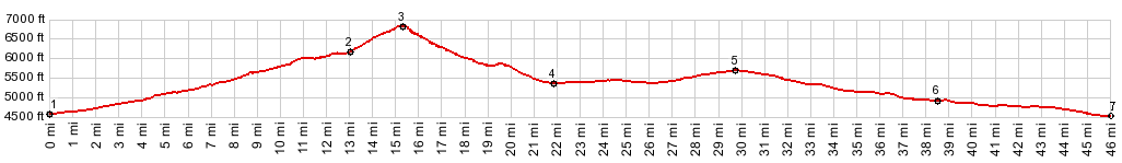
Emery Pass
This is the highest point on the
road through "City of Rocks" National Preserve.
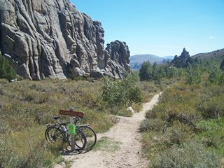
This area is especially popular with rock
climbers. The old California Trail skirted the
area, but did not cross this pass. But in 1848
wagon travelers bound for the Willamette Valley in
Oregon wrote descriptions of this granite outcrop
scenery, and now one can read them next to the
road across this pass.
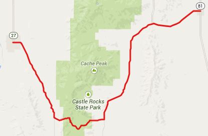
From West. Leaving the small town of
Oakley ( one grocery store, even open on Sundays )
towards the west, the turnoff onto Birch Creek
Road and "City of Rocks" preserve is clearly
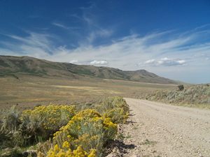
signed. This road heading south is heavily graveled and
passes between two sage ravines, that do not
change, even if the road climbs 600ft. Clearly
this is not the most attractive part of the ride.
Just after the road seems to reach a top in this
sagebrush hillmania for the probably 10th time, it
actually does reach a summit for real. But now the profile turns off this road, and
continues to climb, now more steeply, up City of
Rocks Road. An interesting view is starting to
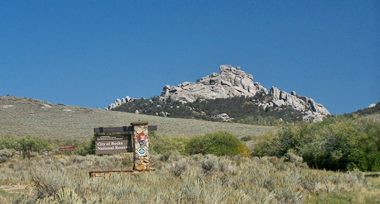
develop to the south. Finally a elaborate sign
post, fashioned of flag rock appears, stating that
the entrance to "City of Rocks" is imminent. There
are a few rock outcrops visible behind the sign,
but from this vantage point the whole thing seems
a little overblown to the unsuspecting first time
visitor. This road is sneaking in the backside.
The east side has ample rewards in the form of
unforgettable views for all the gravel behind.
From East. (described downwards). My
notes say something about an elevation sign saying
"6130ft", but the profile shows that this road
goes higher. A few feet later comes the Emery Pass
Picnic area, where first views of rocks standing
like city blocks become visible. Signs evoke the
impressions of old historic visitors and
scientific perspectives. I won't try to add to
these descriptions. I'll include pictures instead.
The road on this side has a much harder surface,
and would be a much better climb than the west
side.
|
||||||||||||||||||||||||||||||||||||
 Approaches
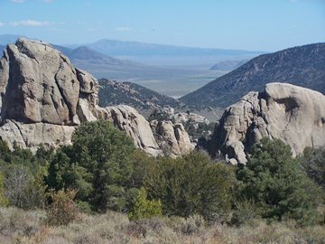
|
|
advertisement |
|
|
advertisement |