| |
| |
Passo Di San
Pellegrino
This pass joins the busy tourst towns in the Val di Fassa with the Bellunesi (or Venetian) dolomites. Approaching from the west and compared with the nearby Sella Group passes or the even nearer Karerpass, this road is relaxing and low traffic. If climbing from the the east however, the workout is anything but relaxing. However, in my opinion the best part of this ride is the scenery along the lower eastern approach, which also makes up the approach to other passes, among them pso. di Valles. That part of the ride is certainly more attractive than the summit, which is nature transformed into ski area. 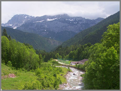 Approaches From West. The road makes a couple
of switchbacks above Moena to a vantage point,
where the Sella Massif at the end of Val di Fassa
comes into view. Then the route enters a forested
valley. There are intermittent steep spots in a
moderate climb, till finally a clearing with a few
businesses comes in sight. It looks like the top
but it's three gentle kms more of climbing to a
group of ski lifts, and a probably closed 3 star
hotel at the top. It's difficult to impossible to
take a picture of the top without a barrage of
kilifts in it. From East. (described downwards) It's a
pretty roll over forested switchbacks. A high
ridge appears in front, and just how high this
ridge really is, becomes apparent with how low
this descent goes. Past the junction with pso. di
Valles comes the best part, but maybe the weather
conspired to make it so in my case. The road
emerges on a balcony above Caviola, and sky
piercing peaks appear upvalley, as well as a sheer
wall downvalley, carved by the river Cordevole.
After the road joins the larger Rte203, a long,
brightly lit tunnel can be circumnavigated by an
old abandoned road that also contains an unlit,
but much shorter tunnel. There also seems to be a
secondary road closer to the stream. a day on a tour:
(<Karer Pass|Pso di San Osvaldo>) Pso di Pelegrino: Fontanac (near Canazei) > Moena > Pso di Pelegrino > small town right next to Agordo: 44 miles with 3900 ft of climbing in 4:3 hours (VDO MC1.0 m4:9.6.7) Notes: includes a few detours while looking for a room. The direct route without the detours took about 4 hours in 40 miles.
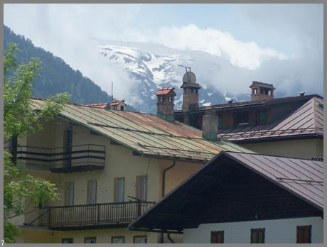
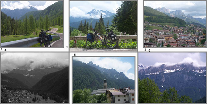
picture locations: pic3 is the only one
taken on the western approach. It shows a view of
Moena on one of the initial switchbacks. pics 1
and 2: east of summit but west of Falcade; 4:
taken from Falcade; 5,7,8 taken from Canale
d'Agordo; pic 6 tken between Canale d'Agordo and
Cencenighe Agordino.
|
||||||||||||||||||||||||||||||||||||||
|
|
advertisement |
|
|
advertisement |