| |
| |
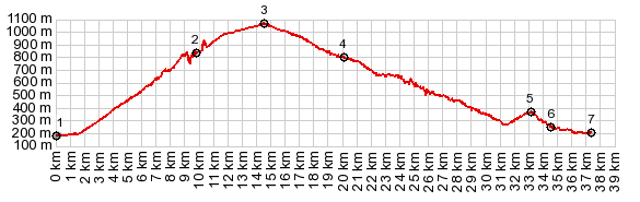
Col de Romeyere
This is a pass in the northeastern
part of the Vercors Plateau, which is part of the
"Prealps". It crosses the first big hogback ridge
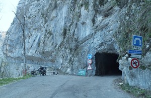
on the edge of this plateau. Its specialty is a
500 meter long, dark tunnel below a limestone
wall, and a short incised canyon section. This is
a small remote road with very little traffic, but
there are yet narrower, more remote paved roads in
this area.
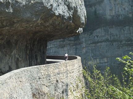
But before plunging into the tunnel : what is
this? A remnant of an old road road leads around
the tunnel , under dangerous looking overhanging
rock, bordered by dramatic drop offs. However it
turns out to be impassable for cyclists or hikers.
After a short distance it becomes all too
apparent, that part of the road has been
completely eroded, leaving no discernible path
along the cliff. But now for the tunnel: It can be negotiated with
the light of a cell phone, at least walking.
That's what I did, but it would have been more fun
and less dangerous with a real dependable light.
But this is not the top yet. The tunnel only
traverses the initial hogback along the Vercors
plateau. On the other side the road turns 90
degrees and follows a shelf road on the edge of a
small incised canyon. This section is short and
spectacular, but it still does not reach the top.
The final part is a long straight traverse along a
high wooded ridge. Plateau climbs often seem to
end less dramatic, than what was encountered along
the way, and this one is a good example. At the top are several rustic buildings, serving
a small ski hill, a restaurant and various trail
heads. It all blends perfectly into the landscape.
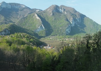
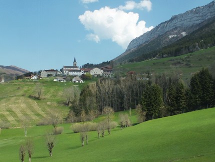
From East. (described
downwards). A curving roll leads through the
village Rencurel. At the junction with the road to
Lans en Vercors the traffic picks up. The church
in Rencurrel makes the perfect visual focal point
in front of the giant step of cliffs. At the next
junction the profile continues downhill. An
extended deep limestone canyon section through the
Gorge de la Bourne follows, again with several
alcove overhangs. I included a picture of this
spectacular canyon section on this page. But it
can serve as lower approach to many summit rides. Several km before reaching Pont-en-Royans, I
could not resist another even smaller, yet
immaculately paved road, climbing to Col de
Croix de Toutes Aures. But the profile
continues downhill beyond "Pont" to Auberrives en
Royan.
Dayride with this point as highest summit: COMPLETELY PAVED: ( < | Tunnel du Morrier > ) Col de Romeyere , Col de Toutes Aures s(u) : St Gervais le port > Col de Romeyere > Rencurel > Croix de Toutes Aures s(u) <> Presles > down D58 > D1532 north back to starting point: 48.9miles with 5530ft of climbing in 5:26rs (garmin etrex30 r5:19.5.20) |
|
|
advertisement |
|
|
advertisement |