| |
| |
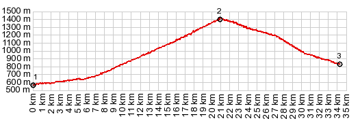
Col de Menee
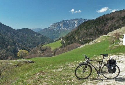
This is a fascinating crossing
between the limestone canyons of the Vercors
plateau and a high valley on its west side. From
there you have expansive views onto the main
ridges of the French alps. As with many Vercors
passes, absence of traffic is major attraction.
But that ends on the bottom of the west side.
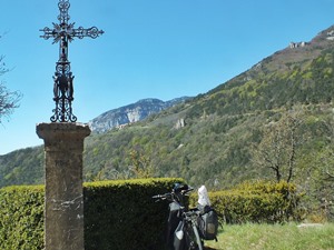
Leaving the medieval clustered houses behind, the
road still skirts along the bottom of the cliffs.
But past the village Menee, the climbing really
starts. Progress can be measured in relation to a
high limestone monument that stands apart from one
of the cliffs. As is often the case here, the pass
turns out to be much lower than perhaps expected
because of a tunnel, somewhere between .5 and 1 km
long through the cliffs at the top. Today this was
probably a good thing because of all the wind and
snow up there.
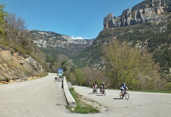
From North. (described
downwards). The road has more rustic qualities on
this side, more curves and a rougher surface. A
perplexingly cube like block of a mountain appears
soon after the top. It is named Mt Aiguille, just
a little higher than 2000 meters. It is definitely
the center of attraction on this side, even
compared to distant views of much higher main
ridges of the alps, still covered in deep snow
further west. Both of these mountain vistas
actually seem to get better as the road descends
and approaches the junction with busy N75 in
Clelles towards Col
de la Croix Haute
Dayride with this point as highest summit: COMPLETELY PAVED ( < Col de Rousset | Col de Pennes > ) Col de Menee , Col de Grimone , Col de la Croix Haute: Die > with detour in Die > Quant > St Roman > Chatillon > Menee > Col de Menee > Chichillane > Clelles > N75 south > Col de la Croix Haute > Col de Grimone > Grimone > Cues des Gats > Chatillon > Quant > back to starting point in Die : 74.7m with 5833ft of climbing in 6:54 hrs (garmin etrex 30 m5:19.4.30). Notes: on the way up Col de Menee I met a Dutch group of cyclists who are here for a week, apparently riding to the top of passes and then back down the same way. |
|
|
advertisement |
|
|
advertisement |