| |
|
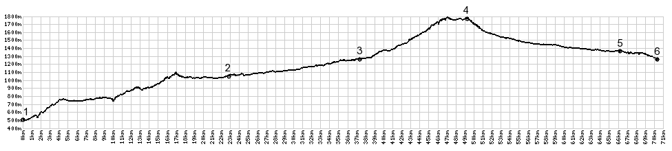
1.(500m,00.0km)START-END EAST: Susa
2.(1050m,22.7km)route goes right; left goes to Col Montgenevre
3.(1260m,36.5km)Bardonecchia
4.(1762m,48.5km)TOP: Col de l'Echelle
5.(1350m,65.4km)route joins N94 from Col Montgenevre
6.(1250m,69.5km)START-END WEST: Montgenevre