| |
| |
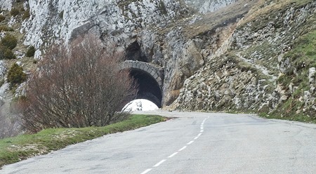
Tunnel de Col de Bataille
s(u)
This is a ride around the inner edge
a high horsehoe shaped plateau. The pass itself
occurs under a triangle of sedimentary rock cliffs
near the apex of the horseshoe. Looking at this on
a regular road map, you get the impression of
crossing several named passes along the way. All
of these turn out just to be shoulder points. But
there is another point along the way that
qualifies as summit, this one not one of the named
passes.
Approaches
Now the road meets up with another coming up from
the valley which makes it possible to substute Col de la Machine
(or D2 across from the same col), also just as a
shoulder summit coming up 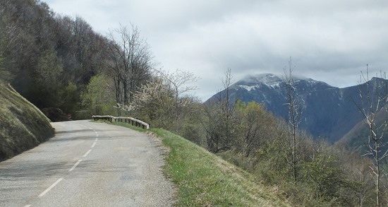 What follows is a long pleasant workout in the
moist forest atmosphere. The only change in
scenery ... the appearance of snow cover next to
the road in this last week of April. The road
breaks out of the forest twice and approaches the
edge of what is now a huge dropoff from this
horseshoe like plateau. This is a summit in its
own right. The drop in road elevation from here is
more than 500ft before the road starts climbing
again,
A final traverse along the rock face leads to the
pass. As seems to be the rule in the Vercors
region, the actual summit is a just a bit higher
than the actual pass. In this case the summit is
at the entrance of a short tunnel through a small
cliff at the top.
From South-East. (described
downwards) This downhill is gradual, without tight
turns, through the forest and steady as they come.
No need to worry about where to buy new brakepads,
or loosing control in a tight turn. Even the road
seems double the width as usual, starting at
Echaillon. Leoncal is an old church with
accompanying infrastructure, so people can visit.
From here a long gradual straight away leads all
the way back into St Jean, following the edge of a
valley for a short distance, but mostly at the
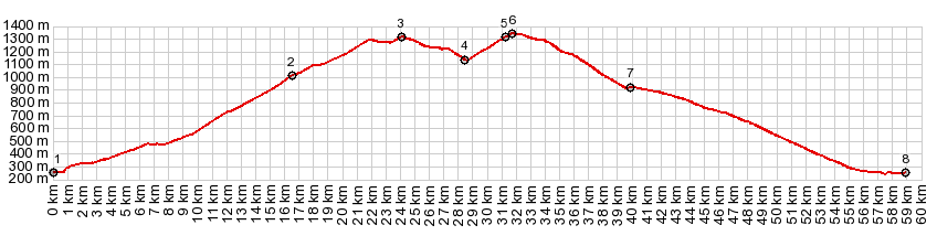
bottom of a wooded valley. 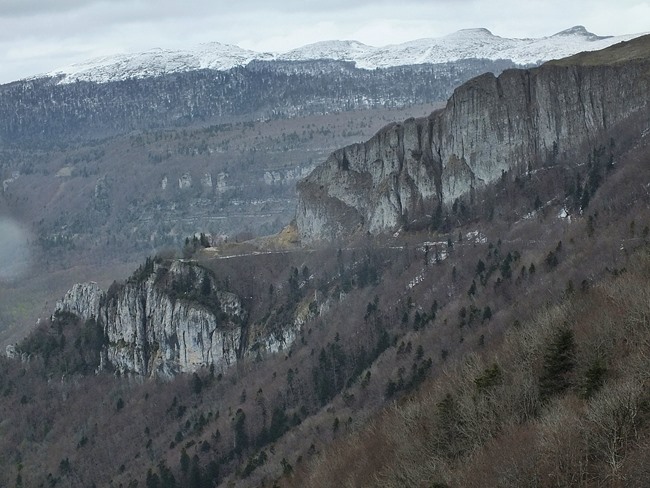 Dayride with this point as highest summit: COMPLETELY PAVED ( < Col de Praletang| Col de Rousset > ) Col de Bataille , D199 Plateau de Montue s(u) : Pont en Royans > Eulalie > St Jean en Royan > Bouvante Bas > Col de la Croix(shp) > Col du Pionnier(shp) > D199 Serre de Montue s(u) > Col de Bataille > Leoncel > D70 north > Oriol en Royans > St Jean en Royans with grocery shopping detour > Eulalie > back to Pont en Royans: 51.7m 5484ft 10.0mph 5:09hrs (garmin etrex30r 5:19.4.27) 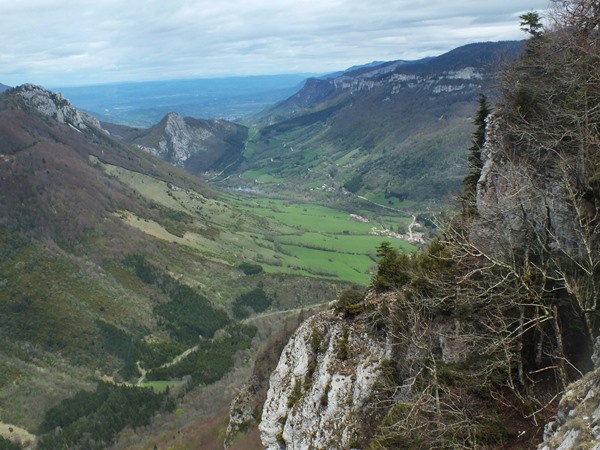 |
 The road traverses up a verdant
valley. The first named pass is Col de Croix, and
on this route it is just a shoulder point. Past
the old church and the usual parade of pruned
trees, a map next to the road shows the road
ahead, but it stilll keeps the topography shrouded
in mystery. Long traverses and a switchback or two
later, it becomes clear the road is heading for
Col du Pionnier. The impressive view of a triangle
of sedimentary rocks in the distance and far above
looks like it has a pass road cutting across it.
Could that be Col du Pionnier. No - but it is what
this ride is heading for. For now a short tunnel
pierces through the limestone lip on the top of
the low section of the plateau - and on the other
side, the Col du Pionnier sign ... and otherwise
just forest and the road keeps on climbing.
The road traverses up a verdant
valley. The first named pass is Col de Croix, and
on this route it is just a shoulder point. Past
the old church and the usual parade of pruned
trees, a map next to the road shows the road
ahead, but it stilll keeps the topography shrouded
in mystery. Long traverses and a switchback or two
later, it becomes clear the road is heading for
Col du Pionnier. The impressive view of a triangle
of sedimentary rocks in the distance and far above
looks like it has a pass road cutting across it.
Could that be Col du Pionnier. No - but it is what
this ride is heading for. For now a short tunnel
pierces through the limestone lip on the top of
the low section of the plateau - and on the other
side, the Col du Pionnier sign ... and otherwise
just forest and the road keeps on climbing.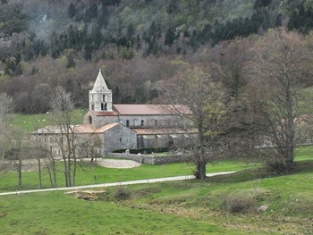 Several signs along the road had
anounced that Col de Bataille was still closed.
However the road turns out be be free of snow, and
it seems like nobody had, as of yet, gotten around
to clearing away a few rocks off the road surface
and removing the barriers.
Several signs along the road had
anounced that Col de Bataille was still closed.
However the road turns out be be free of snow, and
it seems like nobody had, as of yet, gotten around
to clearing away a few rocks off the road surface
and removing the barriers.|
|
advertisement |
|
|
advertisement |