| |
| |
Cormet d'Areches
While on the top of the adjacent Cormet de Roselend probably multiple groups of cyclists posed for pictures, I didn't see a single other two wheeled traveler, bicycle or motor bike on this crossing. The Cormet d'Areches is very scenic and reaches higher than the Cormet de Roselend. But this road is unpaved and a mountain bike is better for this surface.
From West. Looking at the
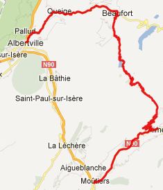
route on the map, the initial approach between
Beaufort and Areches is a side road, compared with
the parallel, initial approach to Cormet de Roselend
. But in my experience it has more traffic. But it
all goes to the town Areches. After that a
peaceful paved road stays fairly close to the
valley bottom until it reaches the barrage de
guerin. Here a sign with a Beaufort Cow as logo
congratulates you on having climbed this one way
paved summit.
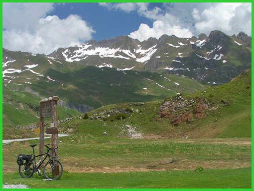
From East. (described
downwards). A hundred meters below the top, a
magnificent vista to the west opens up. These high
peaks are in the Vanoise National Park. Descending
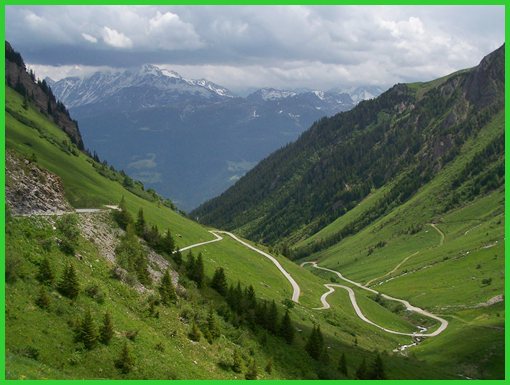
through tundra, the curves in the switchbacks
become paved, while the ramps remain dirt road.
When the entire road becomes paved the descend
becomes very fast and straight. Emerging above the
valley, still 1000 m above its floor, the road
connects 3 high villages along the long ramped
descend. All of them have the locally
characteristic church towers and narrow passages
through the villages. The profile continues North to
Moutiers. Along the way the National Route goes
through a long tunnel. It's well lit and also has
a bike lane. Connecting below Moutiers to
Albertville takes a little time sorting out on a
first ride. Many signs, directed at motor
vehicles, constantly lead the cyclist onto the
National Route. This road however is closed to
bicycles below Moutiers, and the cyclist has to
look for the adjacent, unsigned service road.
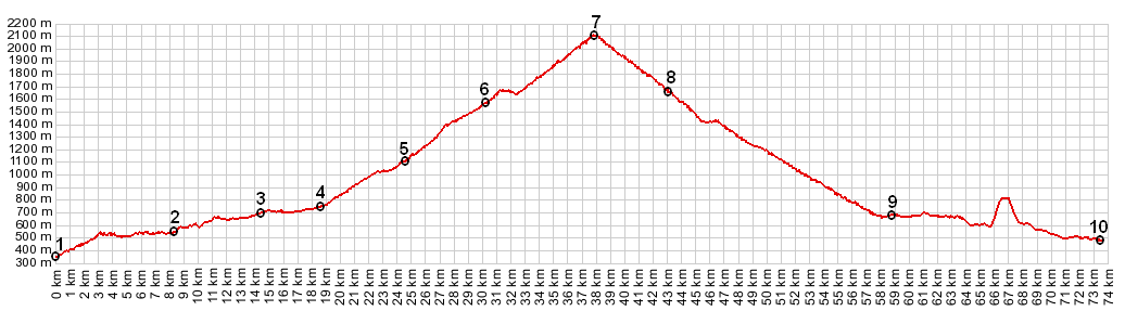
Dayride: PARTIALLY PAVED / UNPAVED Cormet d'Areches, Col du Pre x2:
Queige > Beaufort > Areches <> Boudin
> Col du Pre > to turnaround point: jct
D922[to cormet de Roselend] << back over Col
du Pre > Areches >> Cormet d'Areches >
Aime > Moutiers > Albertville > sp:
82.0miles with 9160ft of climbing in 7:48hrs (VDO
MC1.0 m4:12.6.20)
The last summit with different start and end points on this Extended Tour was Cormet de Roselend |
|
|
advertisement |
|
|
advertisement |