| |
| |
The Ammersattel is a low
gentle secondary pass between Austria and
Germany. It has a major scenic attraction on
each side: a rugged lake, the Plansee on the
Austrian side, and a decadent Schloss on the
German side. When I cycled it, the road was
closed to automobile through traffic, and
therefore wonderfully quiet, but I
imagine this secondary road through the
largest contiguous nature reserve of Germany
is fairly quiet at other times too.
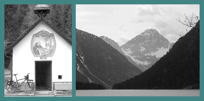
Approaches From West. The roundabouts of Reutte, Austria label the route up to the pass with "Plansee". The third roundabout finally points upwards, and a road with many slight turns follows the valley of the Arch. The Plansee is one of very few lakes that until recently seemed to be forgotten by the real estate developers. But now there is also a new hotel taking root next to the narrow curvy road. The adjacent Plansee and its rugged, glaciated triangular peaks are the major attraction along the route. My map labels the border post as the saddle, which is correct. But the point of highest altitude comes prior to saddle, in Austria. At the top are a few curves that could pass as switchbacks, but not very steep ones. From East. (described downwards):
It's a long gentle descent through deep
forest, periodically opening up views on the
braided stream of the Lindergries. Schloss
Linderhof is a few kms off the main road, but
the decadence is worth the detour. You might
even say the decadence mandates a detour. From
Linderhof downstream, and I think also above
there, a mostly unpaved bike route follows a
path separate from the road. I took the road.
There are many "Zimmer frei" opportunities in
Graswang, but not much in the way of eating
opportunities. Continuing downhill, a left on
a small road that could be a bike path in its
own right, but has an additional bike path
next to it leads to Oberammergau, passing
through a rare alpine wetland scenery
foregrounding the walls of the Estergebirge.
Extended Tour.
(<Ammersattel|Ettal
Sattel , Scharnitzer Pass , Seefelder Sattel ,
Brenner Pass>)
Ammersattel: Fuessen
>Reutte >Ammersattel > Oberammergau
-> Bad Kohgrub >Seehausen bei Murnau: 46
miles with 4200ft of climbing in 4:4 hours.
Notes: also includes 2
climbs to Neuschwanstein and one climb to
Hohenschwangau.
A dayride, starting from the
endpoint of this day, Seehausen bei Murnau,
are on page:
The first dayride over a pass
after this pass was from Kruen with highest
point:
Hochalmsattel back
to Cycling Passes in Europe |
|||||||||||||||||||||||||||||||||||||||||
|
|
advertisement |
|
|
advertisement |