| |
| |
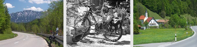
Achenpass
This low pass has barely any
climbing associated with it and stays in the
foothills, though a few higher mountains are
visible through the trees
Approaches From North. B307 heading south from
Tegernsee barely gains any elevation until it
passes through Glashuette. From there its a
straight km or two to the pass. Here there's a
pass sign, a bus stop and a conglomeration of
houses; no scenic view of any kind. This can be
quite a busy road. The only additional trail or
shoulder, that can be used by off road cyclists,
is a rough track on the left side of the road for
the last few kms. From South. (described downwards). There
are more turns on this side. Achensee remains on
the other side of the Austrian border, as the
downhill bound biker turns right into the
Walchental
Dayride: Achenpass : Bad Toelz >Tegernsee >Achenpass >Sylvensis See >Vorderriss > Eschenlainetal > Eschenlohe >Murnau (72 miles with 3700ft of climbing in 6 hours, as measured with a (VDO-MC1.0 m4:9.5.20). Notes: with shuttle The last page with different start and end points on this Extended Tour is: Ammersattel
back to Cycling Passes in Europe |
|||||||||||||||||||||||||||||||||||
|
|
advertisement |
|
|
advertisement |