| |
| |
Hochalmsattel
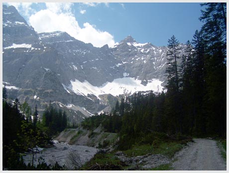
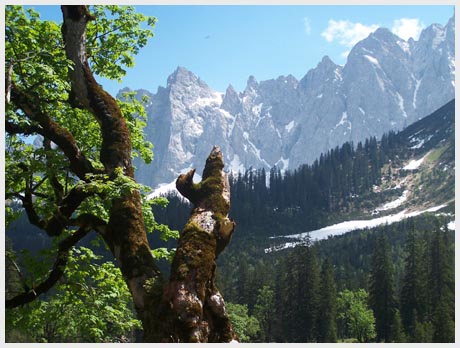
A ride over the Hochalmsattel is often described as the classic great Karwendel mountains ride. These amazingly steep mountains could be mistaken for the dolomites because of there sheer cliff faces. The ride is also often referred to as going to the Karwendelhaus, which is just short of the summit. When crossing the saddle, the ride contiinues down the other side, which adds to the scenic variety with a small mountain park of old several hundred year old "Ahorn" trees and a deep mountain stream gulch, not to mention more great cliff faces. 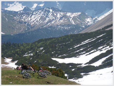 Approaches From South. The turnoff up the
Karwendelvalley is in the Austrian border town of
Scharnitz, just north of the church and the bridge
across the river Isar. The sign at the turnoff is
easily missed. The narrow paved road is lined with
a few guest houses. The route turns steeply uphill
at the next left, signed Karwendelhaus. The long
Kawendelvalley runs between the two major ridges
of the Karwendel group of mountains. The northern
ridge is named the Karwendel chain, the one to the
south the Vomper chain. The road climbs and drops
intermittently between these two amazingly steep
and straight ridges, so that the smooth double
track trail seems to gain altitude slowly. Finally
a large clearing opens the view on the saddle with
the Karwendelhaus. Steep switchbacks lead to the
top. The Karwendelhaus is a little lower than the
saddle and 1km off the route. The saddle is above
treeline and on sunny weekends a busy gathering
spot for cyclists.
Dayride:
Hochalmsattel: A loop ride from Kruen(Germany) > Scharnitz(Austria) > Karwendelvalley > Hochalmsattel > Hinterriss > Vorderriss > Wallgau > sp: 50.5 miles wtih 4000ft of climbing in 5:1 hours, (VDO MC1.0 m4:9.5.23). Notes: which includes one wrong turn in Scharnitz and shopping for the day's food The last page of a day on an extended tour is: Achenpass
|
||||||||||||||||||||||||||||||||||||||||||||
|
|
advertisement |
|
|
advertisement |