| |
| |
FR31 s(u)-1
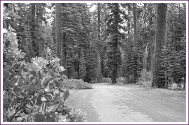
FR31 leaves Mount Shasta City
as part of the Old Mc Cloud Road, an abandoned
road that now makes a great mountain bike
ride. When it intersects Ski Park Hwy, FR31
now follows a path a little further up the
slope of Mount Shasta, north of the old Mc
Cloud Road. My map also shows the Old Mc Cloud
Road, descending to the village with that
name, but I could not find it.
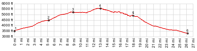
Approaches From West. The profile
starts just south of Mt Shasta City and goes up
Snowman's
Hill s(u). You could start much lower
still. The description starts higher where FR31
crosses Ski Park Hwy, continuing west on FR31.
The old pavement on this road becomes
increasingly spotty, until it finally completely
disappears. Clear cut logging areas become
increasingly common, as you approach the east
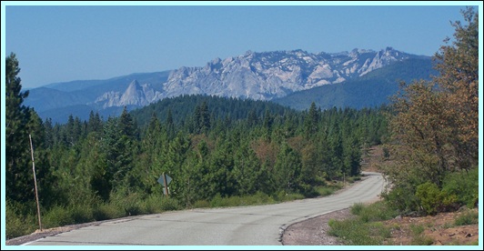
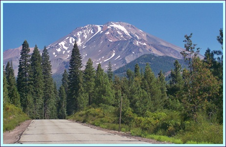
side of the mountain. Riding this made me look
at the nearby Everitt Memorial Highway
differently. Before I saw it as passing through
a representative landscape. Now I see it as a
very carefully selected peace of land, along
which care has been taken to leave everything in
immediate eye's range in its natural condition.
Riding this road shows how uncommon this
condition actually is. The summit point is not really
noticeable on a bike. For me it was still a joy
to ride this road, because it follows every
contour of the land, winding north and south
along every drainage. Its general eastward
course seems almost to happen by accident. And
the occasional incredible backdrop to the north
didn't hurt either.
From East. (described
donwards). More clear cut areas. Still, I never
met an actual logging truck. - At the jct with
FR19, the profile descends back down to Ca89, in
order to show a big approach on this side. My
own ride continued around Mount Shasta - turn
left towards FR19
s(u)-2 A Dayride with this point
as intermediate summit is on page FR19 Deer
Mountain Rd s(u)
|
|
|
advertisement |
|
|
advertisement |